Category: ru29 (Page 4 of 22)

Westward Current Continued

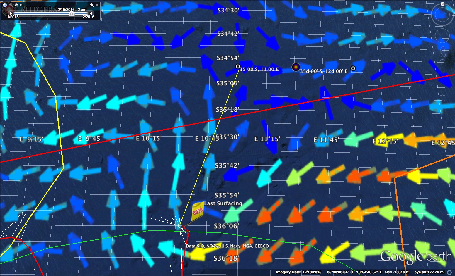
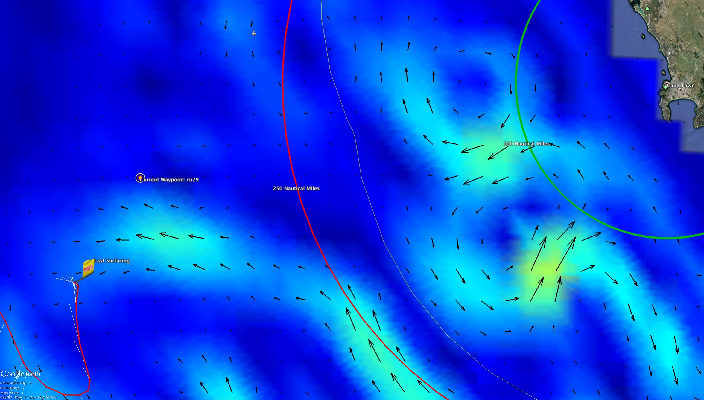
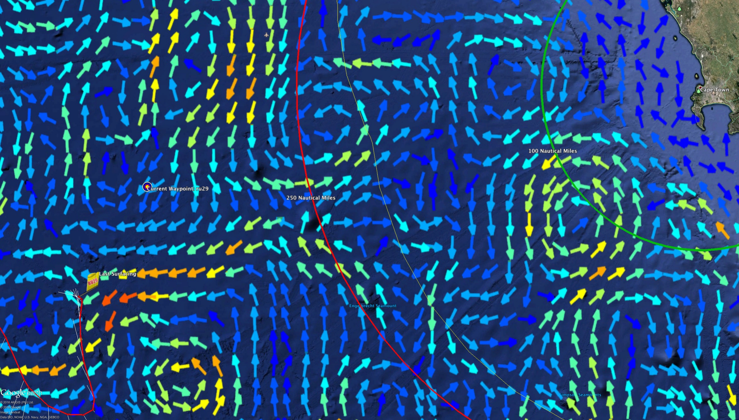
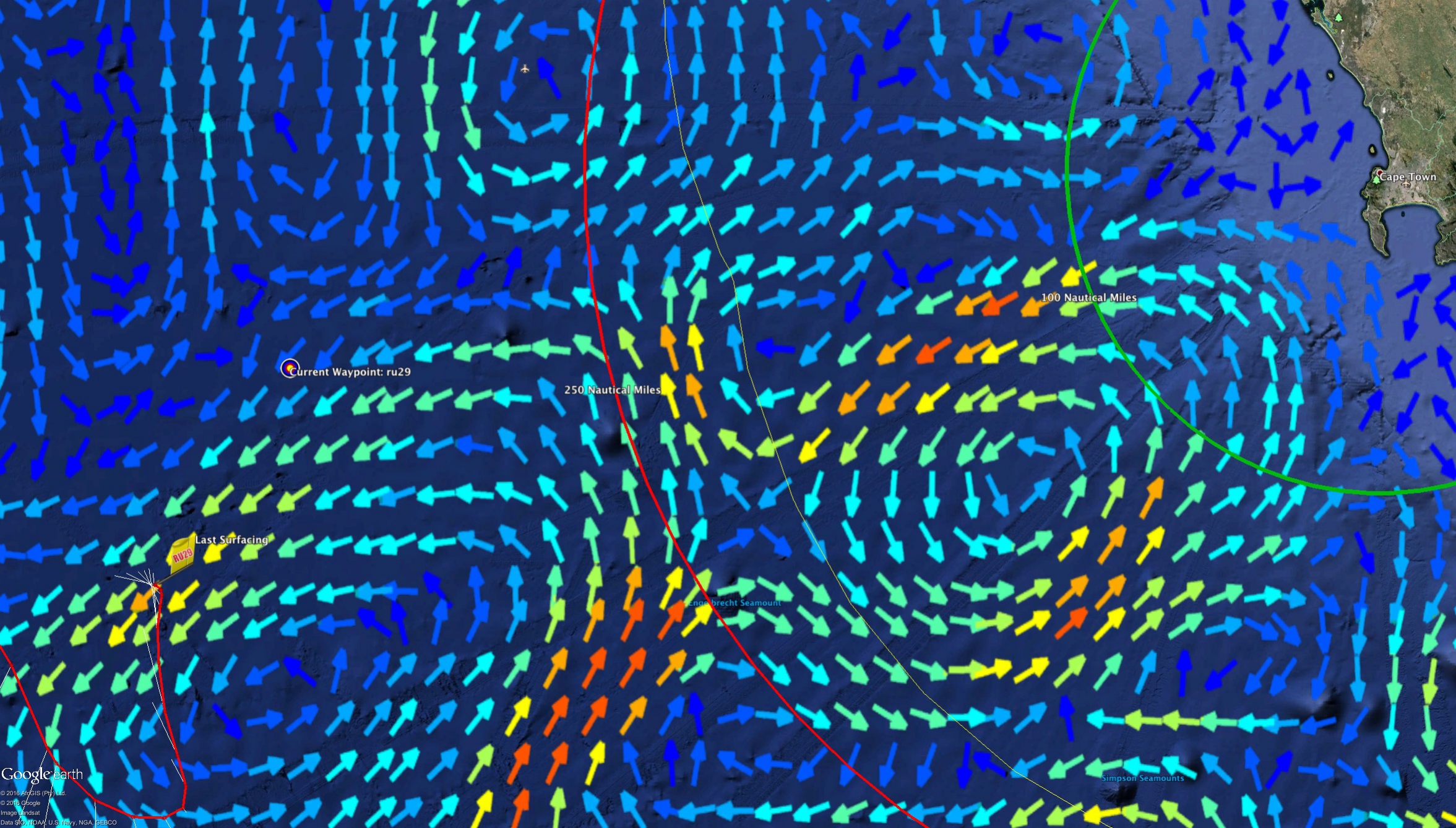
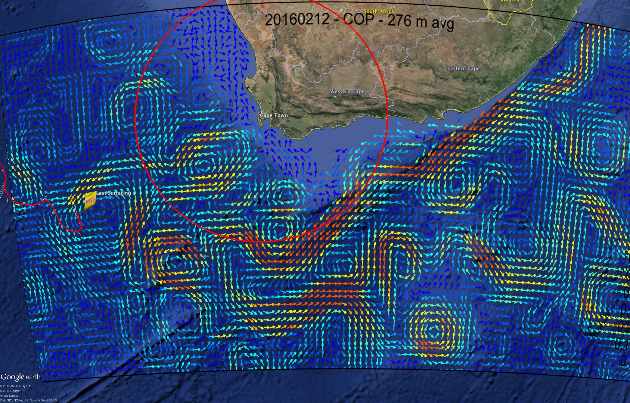
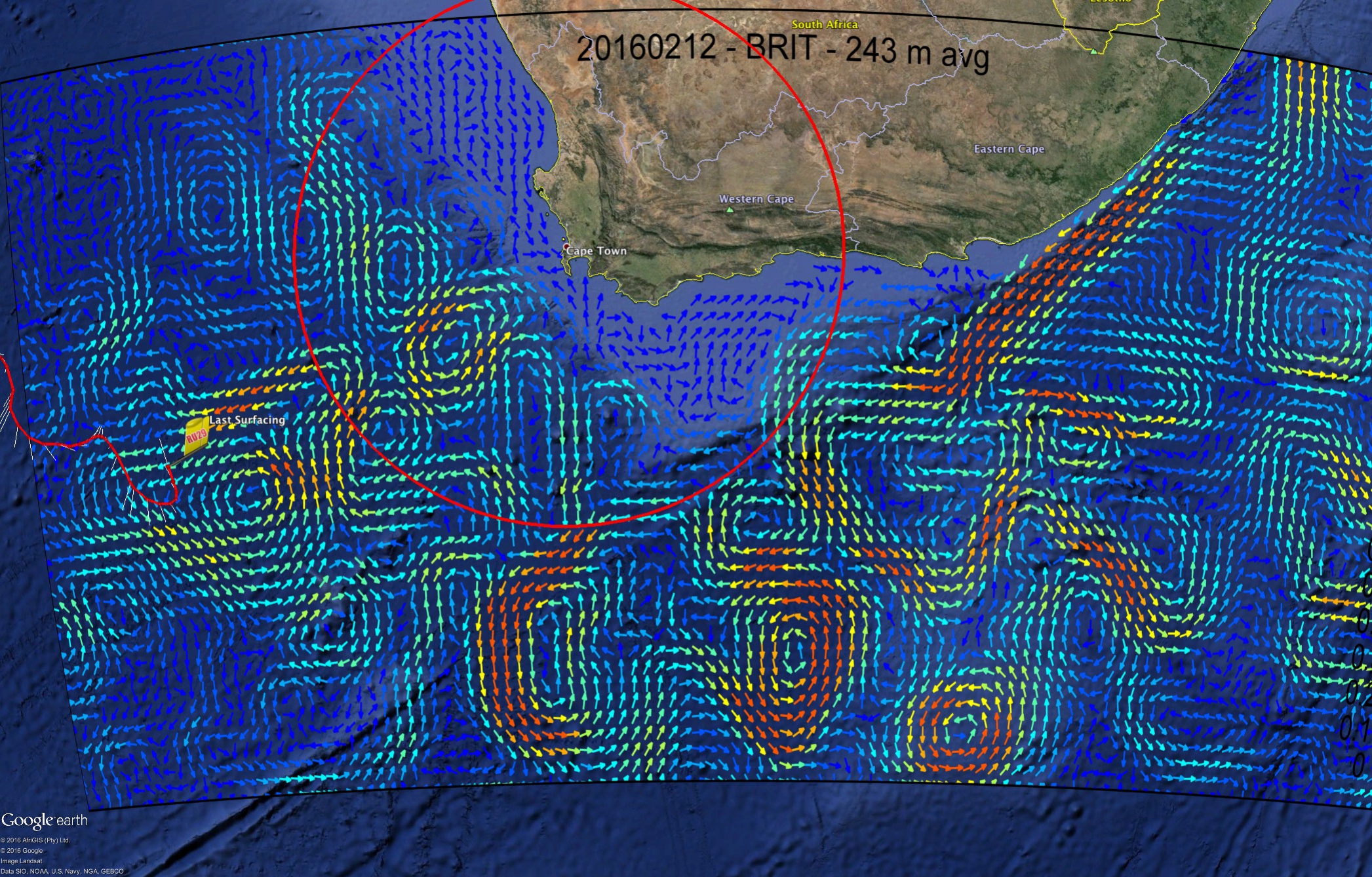
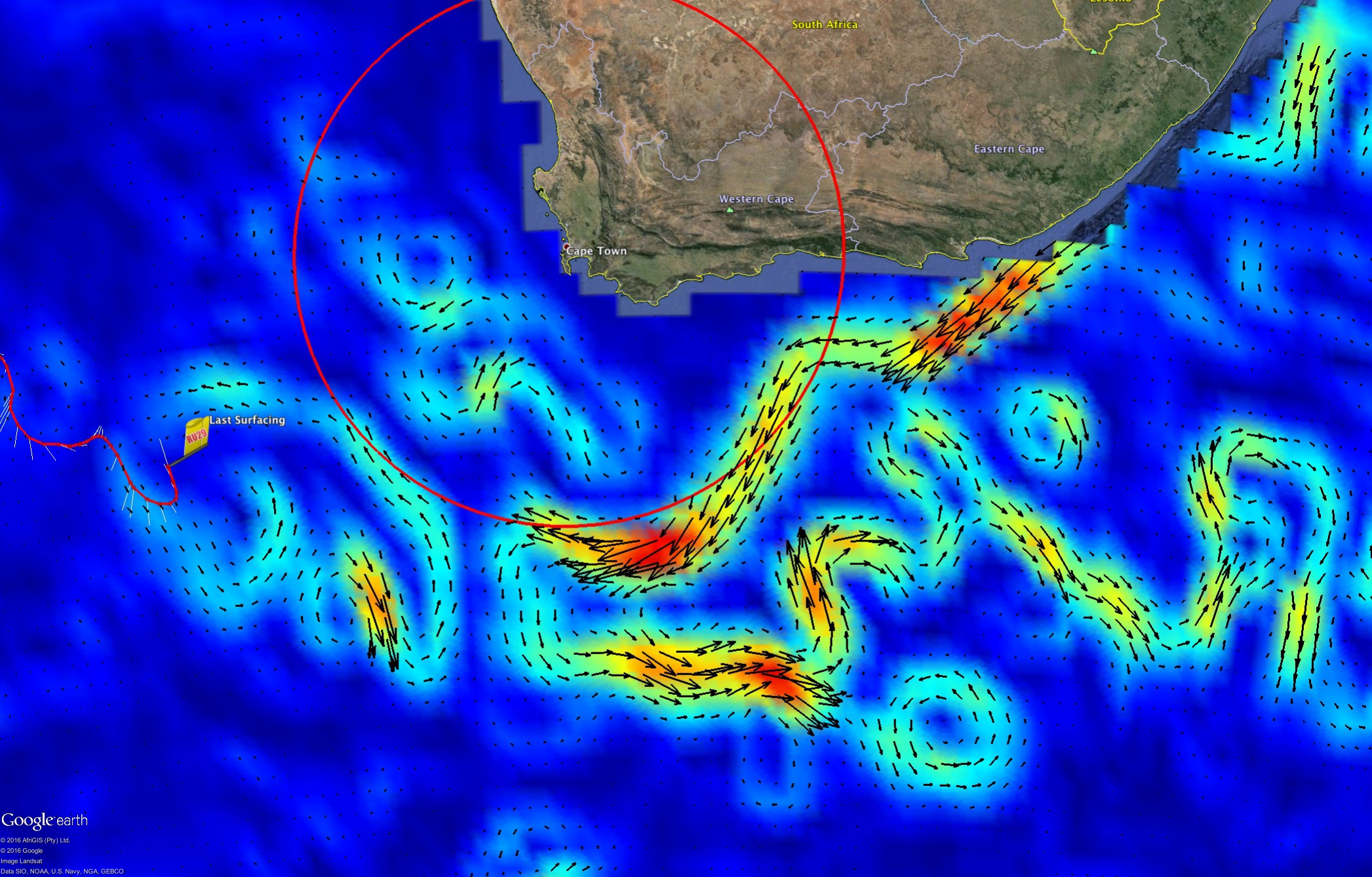
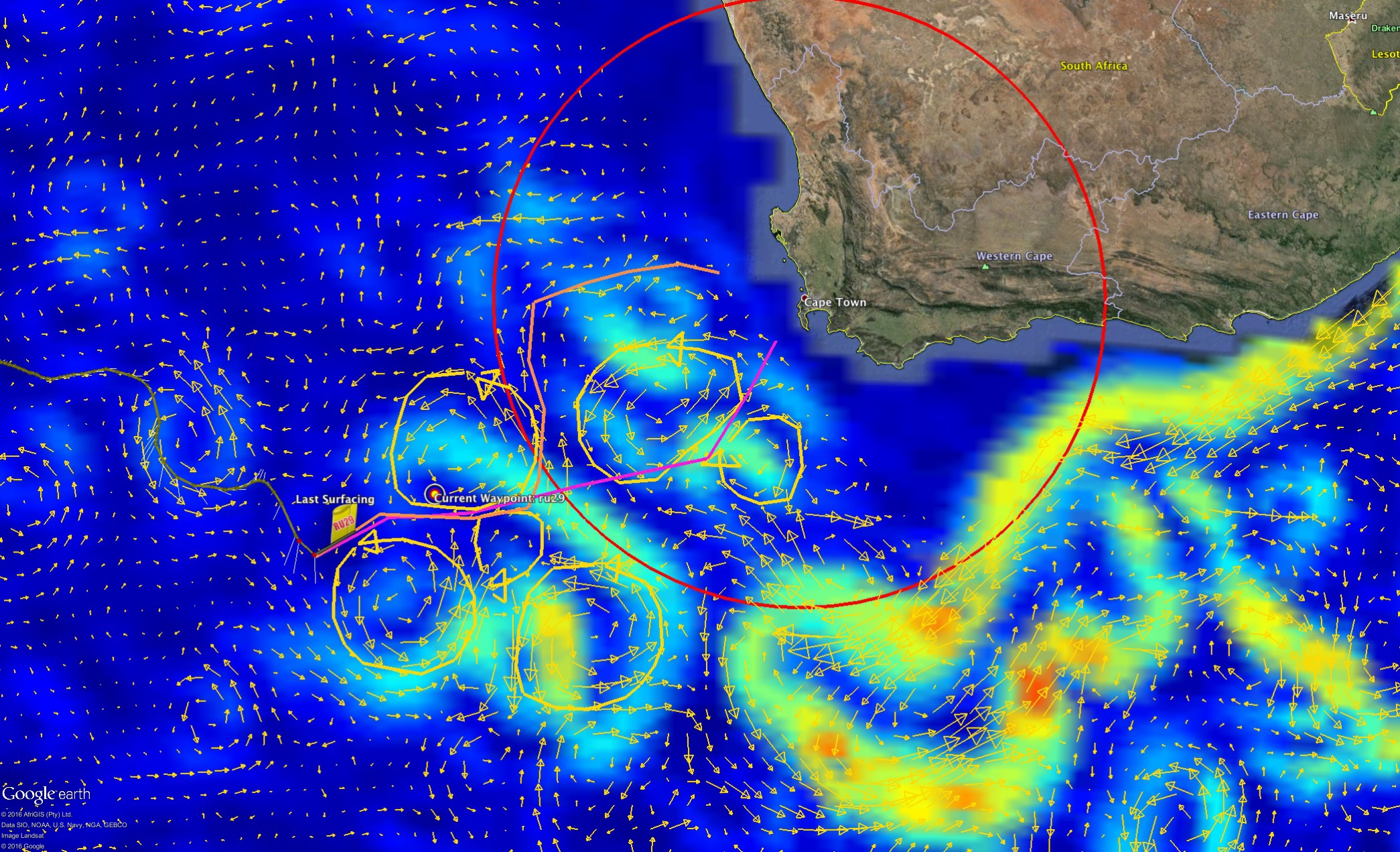
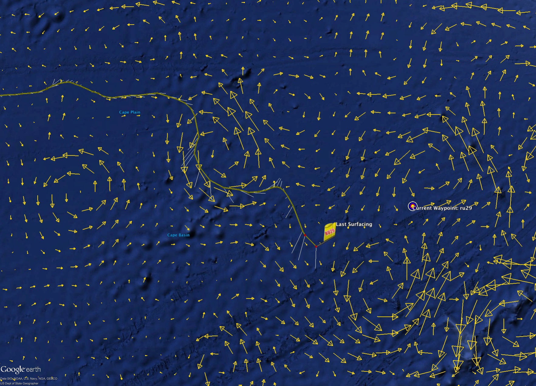
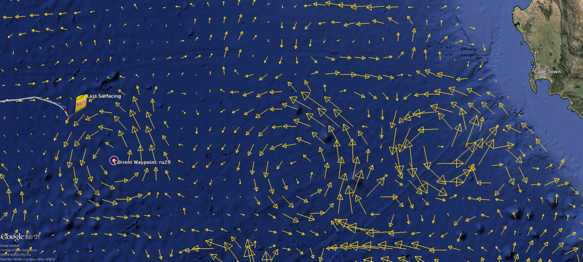
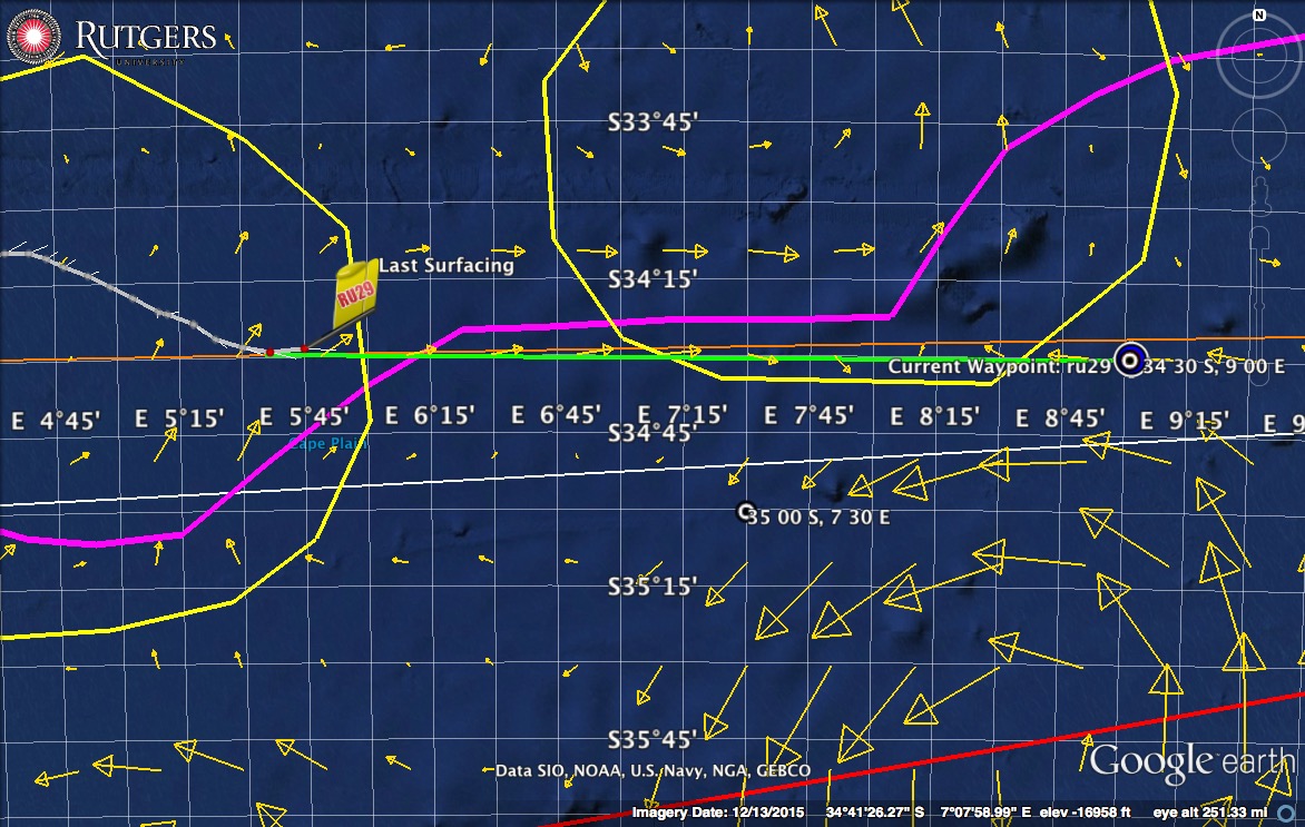
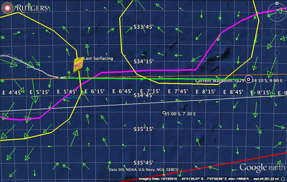
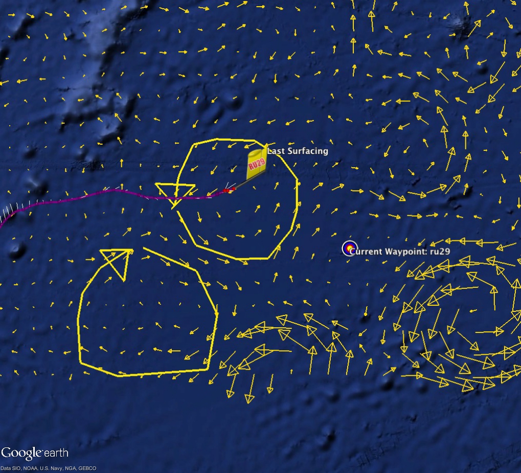
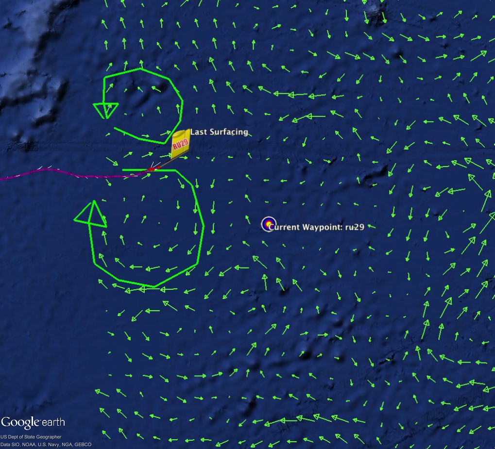
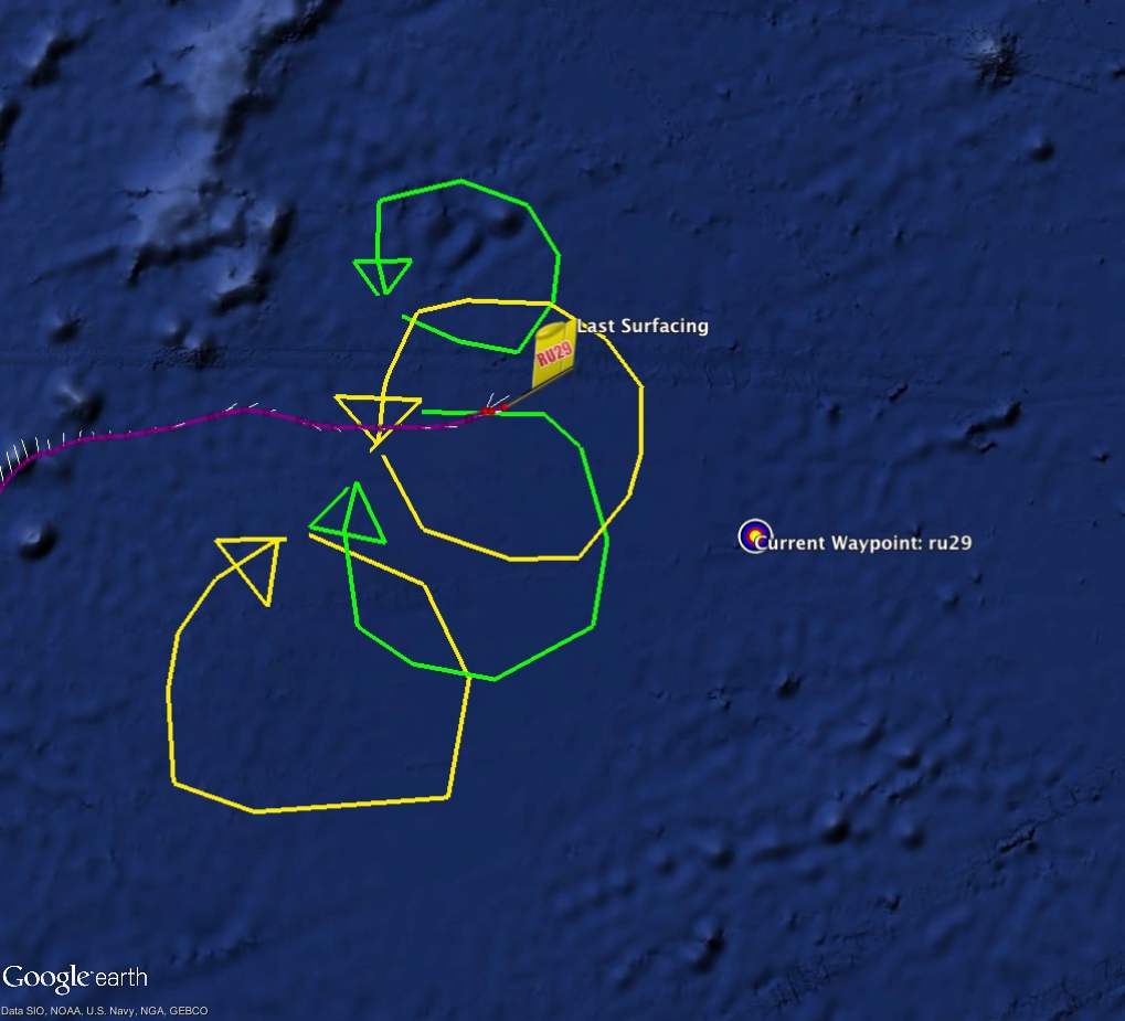
On Friday, we left off with Challenger struggling to make progress across a powerful jet that continued to push westward.  However, as we made our way into the weekend, the currents slowly but surely started rotating to a more favorable direction from nearly due west to having more of a northern component.  This was very nicely shown in the copernicus forecast where challengers reported currents while entering the domain of the cold core eddy matched that of the model.

RU29_20160221_OutOfEddy

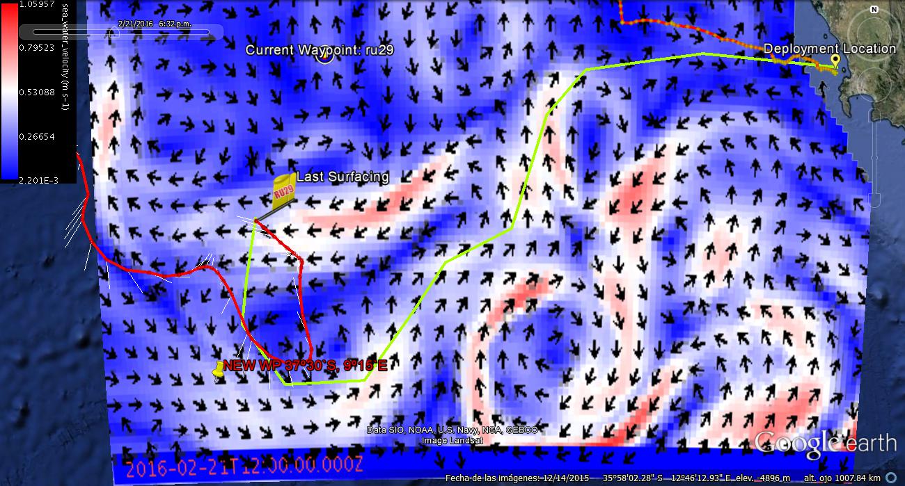
By sunday afternoon, Challenger began showing the currents rotate back west, again slowing the gliders progress and pushing her back to the west.

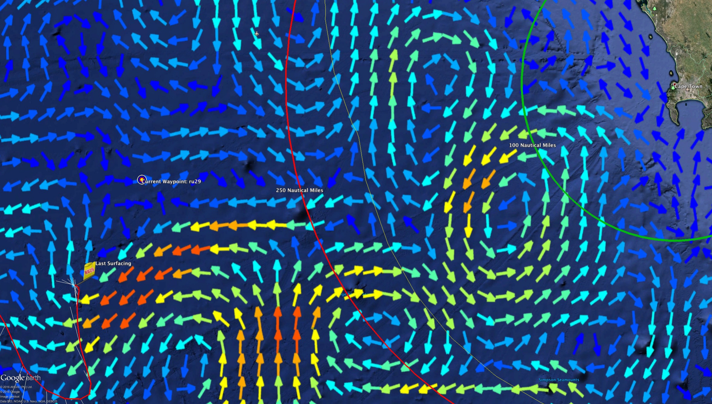
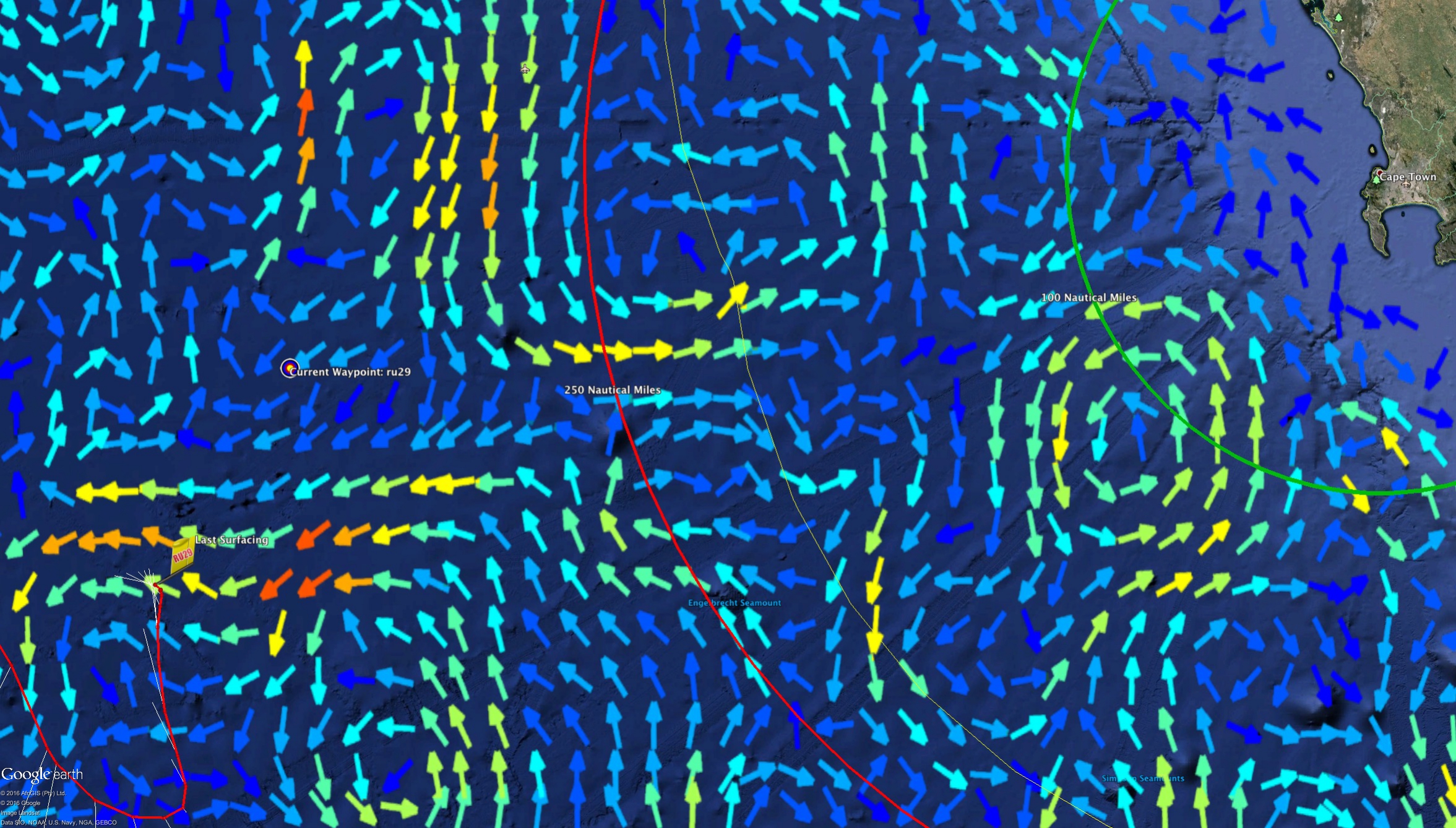
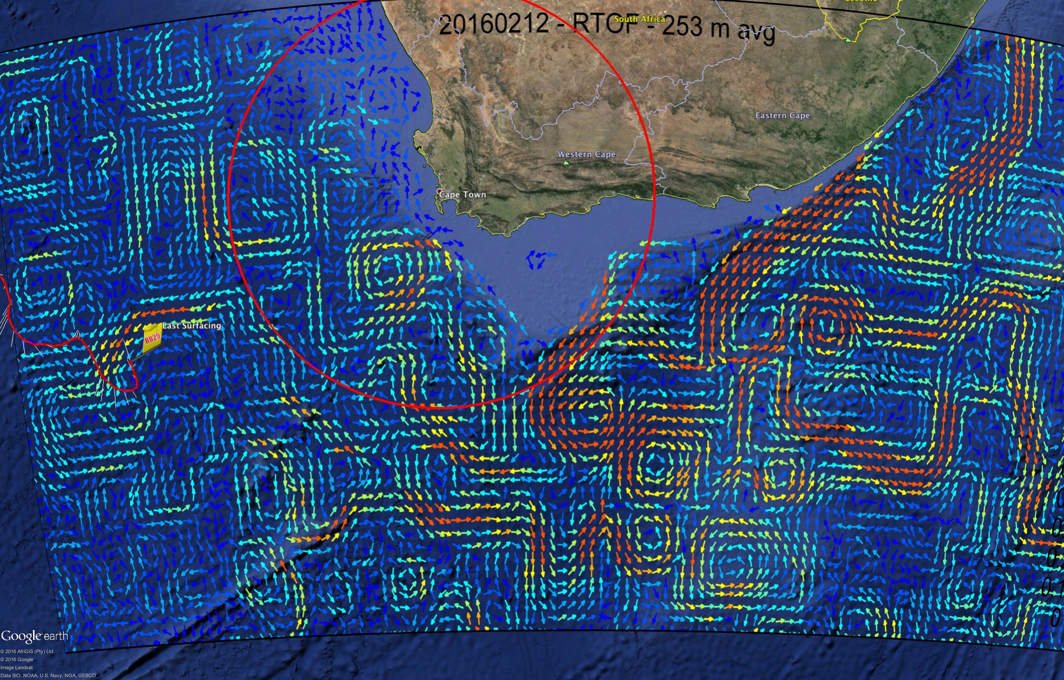
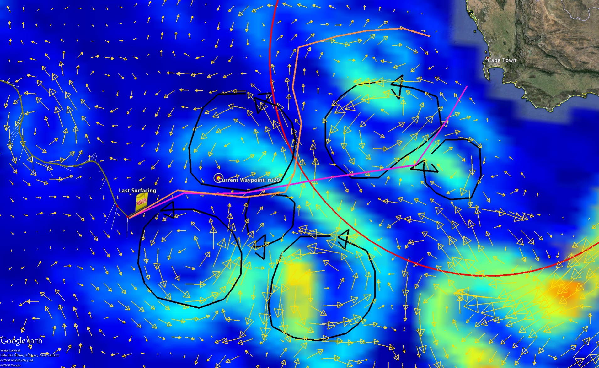
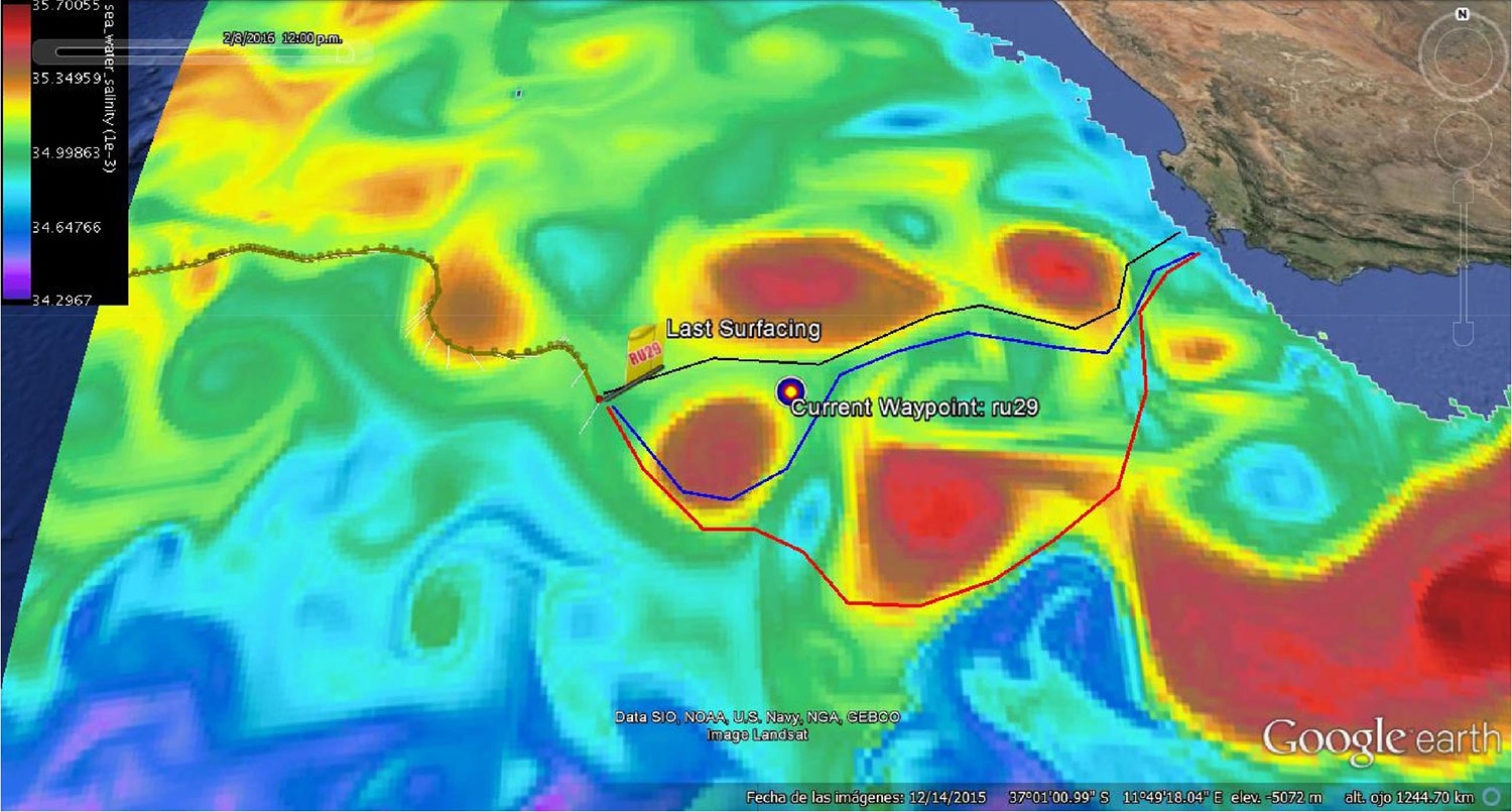
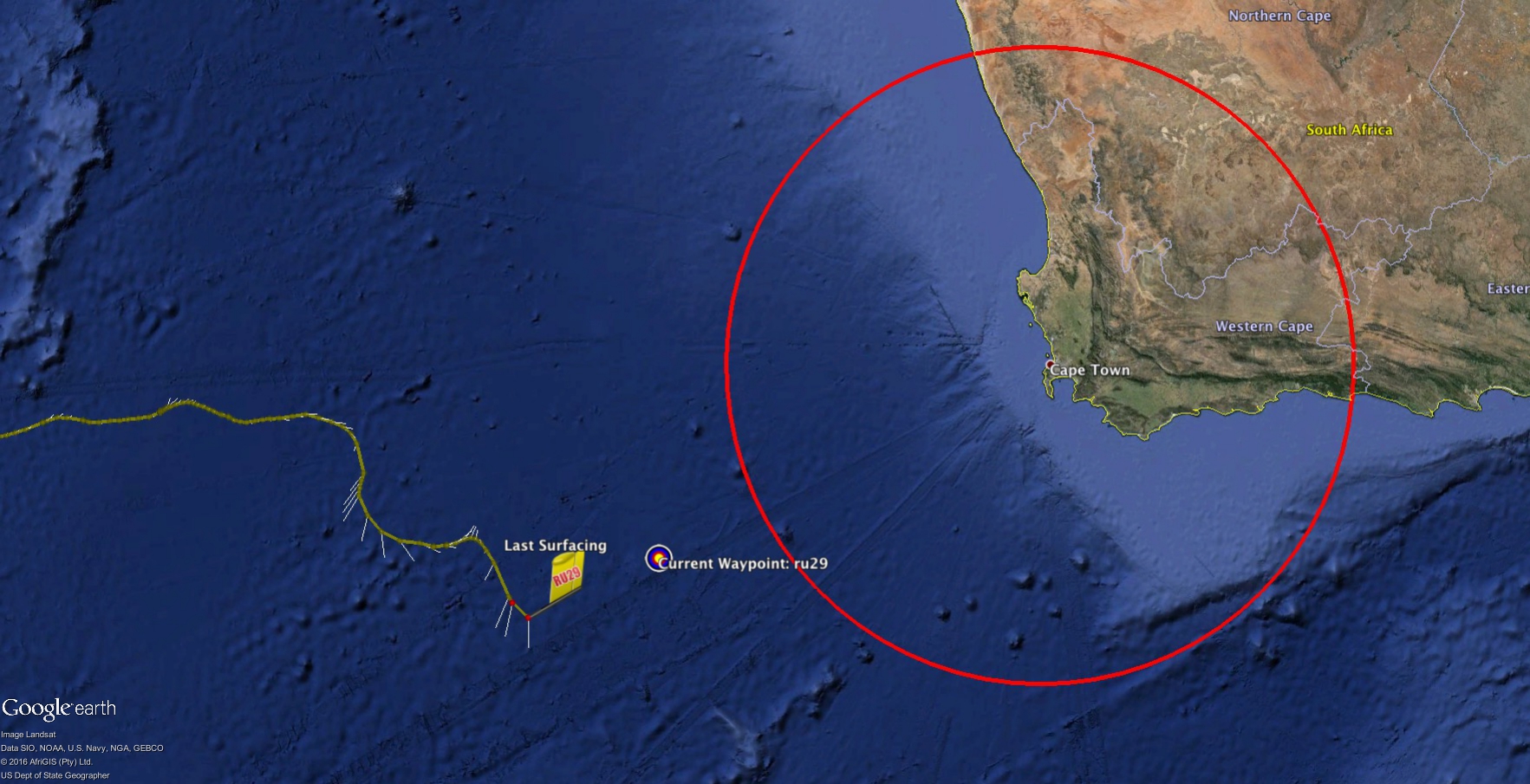
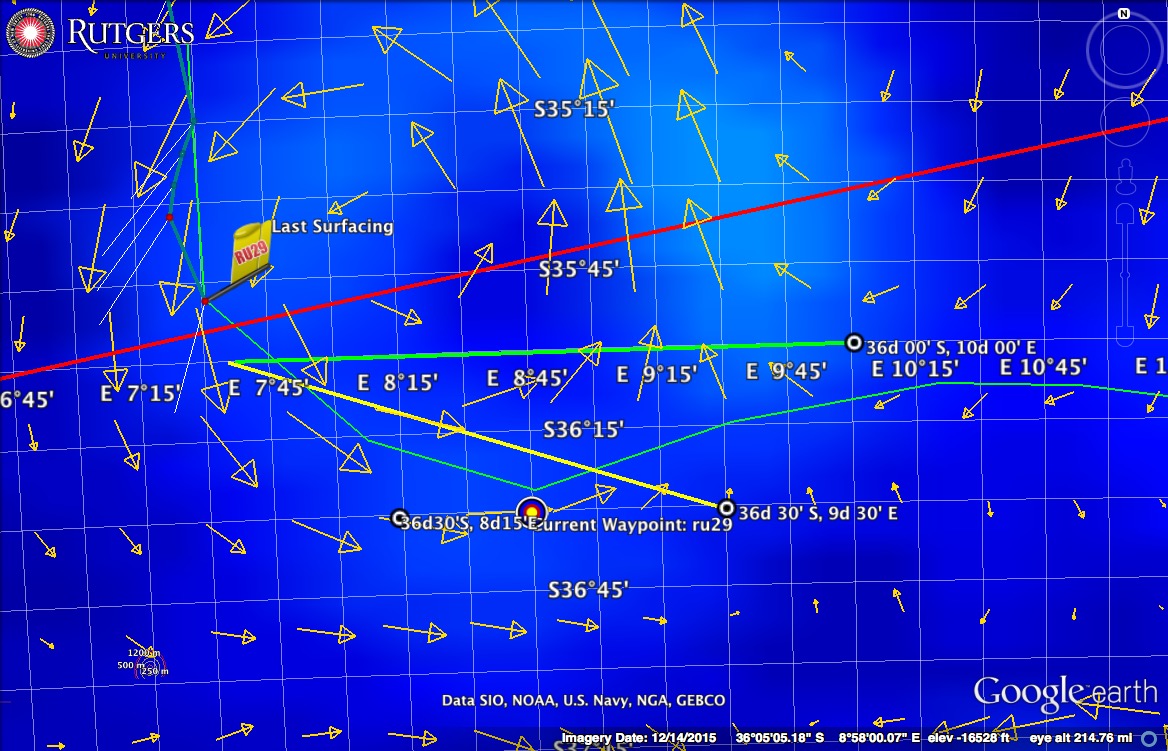
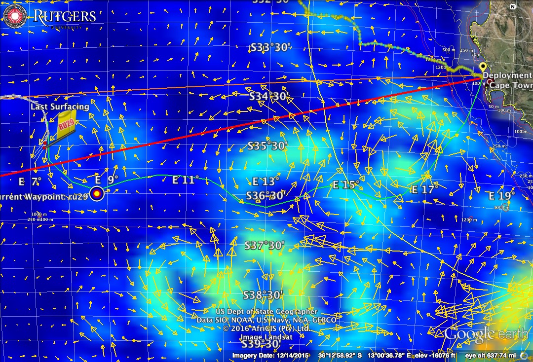
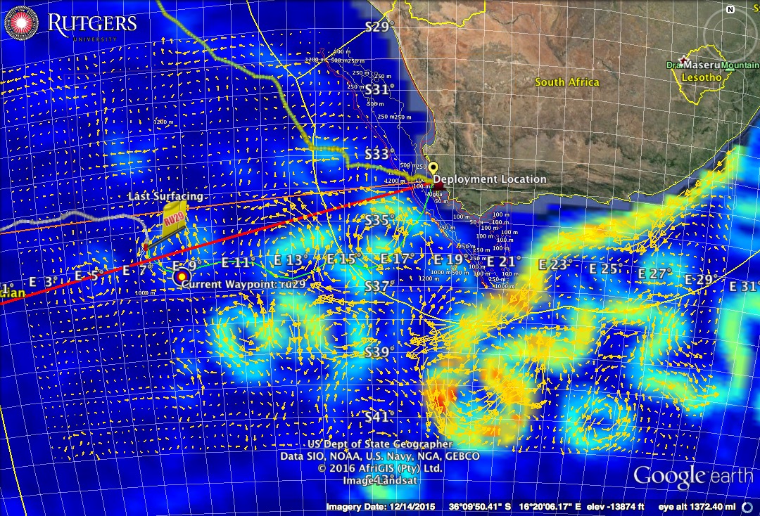
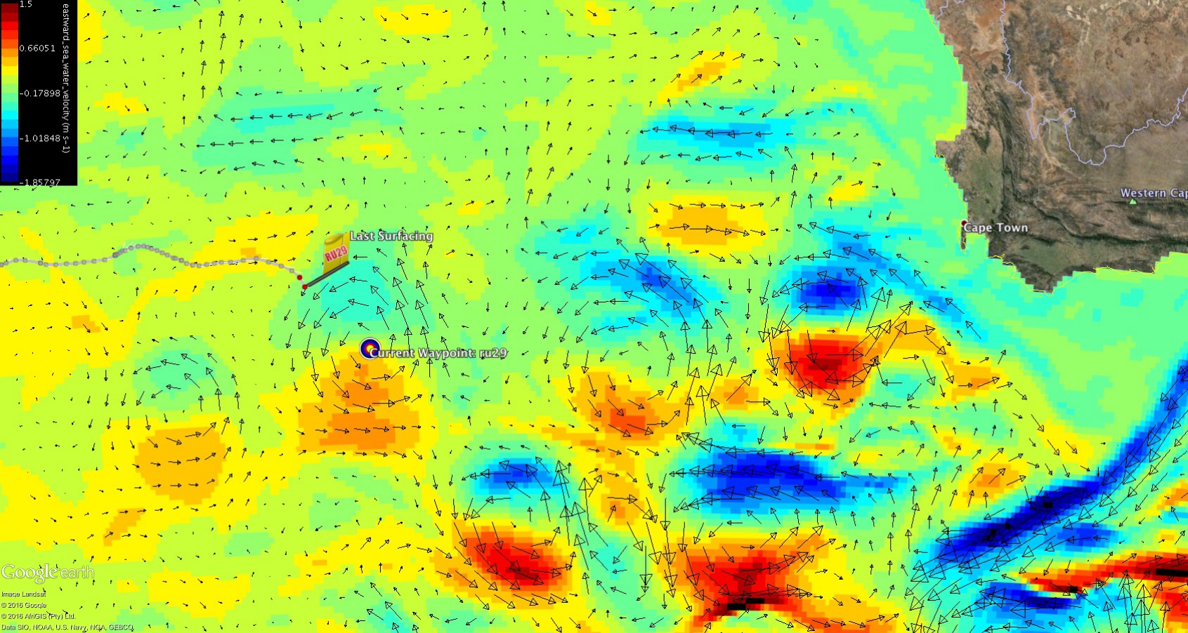
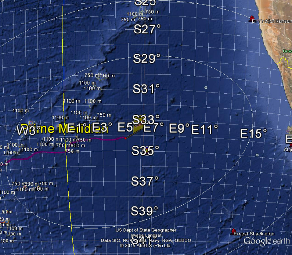
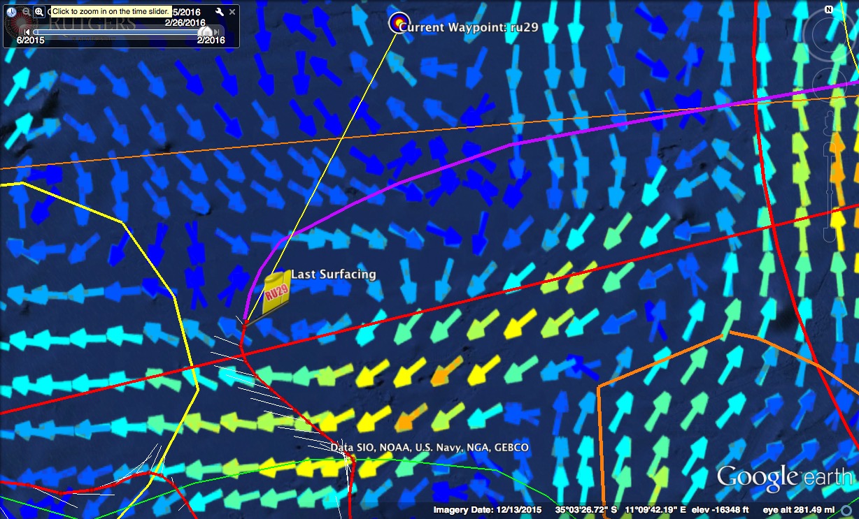
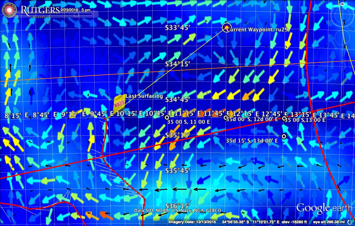
As we start off this next week, we will move the way point to the NE  50% north 50% east of the glider speed.  This we hope will give us the best shot of making it safely between the eddy to our east and west as seen in the RTOFS map below, so we can hopefully safely maneuver towards Cape Town.

RU29_20160223_RTOFS

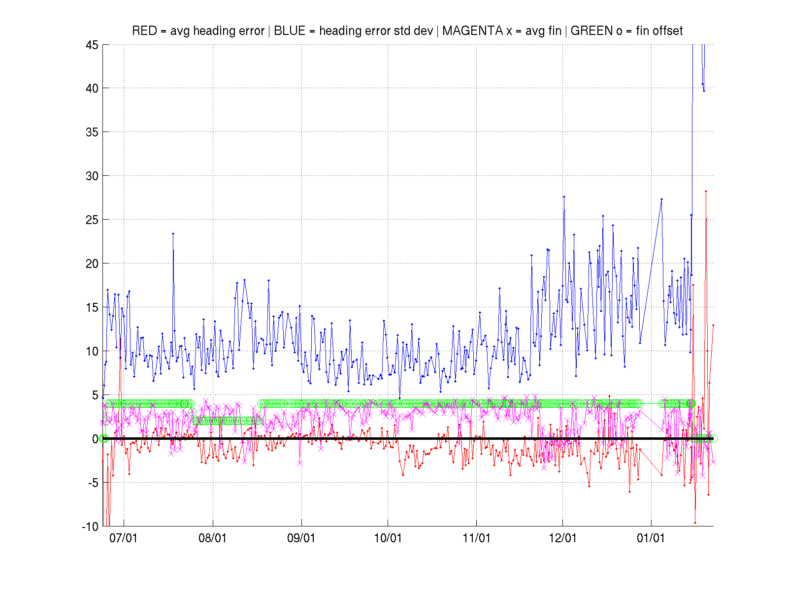
The batteries are still holding well, giving us an estimated 100 days remaining which will hold us over until the end of May.  As of now, we have two potential recovery windows at March 29th – April 1 and April 18 – 30.

Force Wind Sea & Honor

Persistance West

With the start of the week, a new way point was issued at 35˚ S 11˚ E to try and maintain a 90˚ angle to the strong current that plagued Challenger through the weekend.

RU29_20160215_waypoint

As the week went on, the strong currents continued to push our glider westward away from our goal of the shores of Cape Town.

Antonio reached out with maps from Copernicus showing that the western jet could be from a large cold eddy – the center eddy of the ‘solar system’ we have now snaked back towards the middle of.

CURRENT 220m 20 FEB 2016

According to the forecast, it looks like we will need to start making some progress if not east, to the north, otherwise there is another clock wise rotating cold core eddy that has the potential to pull us further west and away from our target.

The discussion has also opened up with our friends Seb and Fred down in South Africa as we prepare to secure a boat for 29’s recovery.  With the glider being only a 2-3 day boat ride from Cape Town, we are hoping to get a boat that will allow an overnight operation such as the RV Alpa Delphini that was used on multiple occasions.

Force Wind Sea & Honor

Overpowering Currents

Since Friday, Challenger has been flying with the way point set to the North East in an attempt to effectively fly across the westward jet shown by the OSCAR Product.

The current however has been pummeling the glider, and over the course of the weekend we went from seeing  the fastest speeds of the mission to the slowest.  At the Friday evening surfacing, the glider had flown 28km in 13 hrs while at this morning’s surfacing just over 4 km of progress was made.

This slow in progress is due to the rotation of the current, from nearly due north on Sunday (354˚) , to just North of West today (284˚)

The way point has now been set to 35˚S 11˚30E to try and get a better angle on the current.

glosea_215

GLOSEA Forecast Feb 15

rtofs_215

RTOFS Forecast output Feb 15

oscar_215

OSCAR Forecast Output Feb 14

hycom_215

HYCOM Forecast output Feb 15

copernicus_215

Copernicus Forecast output Feb 15

The KMZ’s for the latest model outputs can be found on the RU 29 Diagnostics Page here: http://rucool.marine.rutgers.edu/gliders/29/ under the heading “Project Links and KMZs”

Over the next few days we will continue to aggressively change the way point as we try and get Challenger out of this strong current and further North so we can make our final approach towards Cape Town

Force Wind Sea & Honor

5 Models

Over the course of this week, the glider team pumped out a number of new model visualization products to aid in piloting.  We are now looking at 5 model out puts in total including RTOFS, Copernicus, OSCAR, HYCOM and GLOSEA5.  The only problem is, none of the 5 models we are looking at agree with the currents produced by the glider.

While RU29 is reporting that the current is strong to the north, the following are todays forecasts from our five models:

Copernicus Feb 12

Copernicus Feb 12

Copernicus is showing 29 should be feeling the effect of warm core eddy as we fly the west side where we should be feeling a current flowing south-soutwest.

GLOSEA5 Feb 12

GLOSEA5 Feb 12

The British GOSEA5 model shows that the current should almost be predominately west with a little bit of a southern component.

HyCOM Feb 12

HyCOM Feb 12

HyCOM shows a current mostly due south with little bit of a western component

RTOFS Feb 12

RTOFS Feb 12

RTOFS is showing the glider entering a strong jet flowing to the south west.

OSCAR Feb 8

OSCAR Feb 8

and OSCAR shows that we are in the middle of an eddy where there should be a very weak southward current.

The glider however is seeing a very strong current to the north which resulted in making 27 km progress during the last 13 hr segment.

The problem with this area is that the current is very dynamic making it nearly impossible for a 24 hr forecast to capture what is truly happening.  One forecast that is accurate however is the wind maps which are lining up nearly perfectly with the surface drift 29 sees when she is calling in at surfacings.

windsfeb12

The next surfacing will be around 6pm tonight. Since we have no idea where the glider will be at this call with the lack of a reliable road map, we will grab the glider when it calls in and depending on its position, we will give it one of two way points (35˚, 12˚ or 35˚ 30  13˚) as we try and fight our way through the unknown current that is pushing 29 to the north.

Force Wind Sea & Honor

Liquid Meccano XXL

0209

Over the past week Challenger blew through the eddy previously discussed and depicted by the copernicus model below.  The european model nailed the forecast here and the currents predicted nearly matched the currents reported by the glider perfectly

previous_week

Looking ahead, we have three options of routes to take to reach Cape Town.  In the map below, we have the Copernicus forecast overlayed on NASA’s Jet Propulsion Lab’s forecast, OSCAR’s magnitude forecasts which both show signs of the eddy solar system which lies between the glider and the shore.  Last night a new waypoint was set to our North East to try and steer the glider north of the large warm eddy to the South West.  If this maneuver can be pulled off, we will then push along either the orange route or the magenta route in the map below.

Untitled

A third option is highlighted in the map below of the Copernicus salinity field provided by Antonio.  If we are unable to get to the northern side of the warm eddy and end up being pushed south, there is a route that approaches Cape Town from the south, however this path is much riskier as it puts us dangerously close to the retroflection which threatens to throw the glider out into the Indian Ocean.

LIQUID-MECCANO-XXL-3-copy-03

Finally, in the image below we have outlined the 250 nautical mile radius from Cape Town.  This distance is important as it is the rough equivalent of how far a potential recovery ship could travel in a 24 hr period.

250nm

Force Wind Sea & Honor

What Was That?!?

As we predicted heading into the weekend, Challenger hit the ground (or eddy) running flying close to 40 km in a day as she began to ride the eddy to the south.

RU29_20160201_waypointSouth

This eddy is a force to be reckoned with and so to try and make sure she doesn’t get swept to the center as we continue to make our way around, at the next surfacing  the way point will be moved to the south west.

RU29_20160201_PathToCapeTown

Taking a step back, we can see the road that lies ahead.  The green line in the image above shows the path we aim to take over the coming weeks, taking 29 south through the eddies that are rolling around the South African Coast before flying north into Cape Town.

RU29_20160201_agulhas

Finally if we zoom out a bit further we get a very impressive view of the Agulhas current along with the retroflection back into the Indian Ocean resulting in the eddy formation process that has been key to both our current approach and when Challenger was leaving South Africa back in January of 2013.

Over the next few days, 29 will continue to make her way around our current eddy and we will do our best to position her for a graceful exit into the next.

Force Wind Sea & Honor

Less than 1000 km to go

Now less than a thousand kilometers from the shores of South Africa, Challenger is breaking speed records as she navigates the outer edges of the eddies rounding the Cape of Good Hope

under1k

This is one of the most energetic areas of the world’s ocean where eddies spill from the Indian into the Atlantic Ocean and we are really seeing their intensity as they propel 29 at speeds upwards of 35 km/day.

eastward

Currently Challenger has entered one of these eddies that will carry her around through the weekend.  In the image above we have the breakdown of the eastward velocity (red means flux to the east while blue is to the west).  According to the Copernicus model which the glider currents are matching at the moment, the souther edge of this eddy is pushing at about .6m/s or 50 km/day!  Through the weekend we will try and keep the glider to the outside as it will be hard to break free if we fall too far into the middle.

As for the status of the glider,  we are steering much better now after a deeper investigation was conducted this week.  A few weeks back when the glider suffered from an underwater reset, the steering parameters that have been tweaked throughout the mission were reset as well.  As time passed the steering was getting worse until this week it was discovered that in the recovery process after the reset, there was an error in the steering parameter by an order of magnitude.  After adjusting this error, the glider is once again steering pretty well as seen in the figure belowru29_heading_StatisticalTimeSeries

Force Wind Sea & Honor

Copernicus Steps Back Up

As the Rutgers team battled winter storm Jonas over the weekend, Challenger managed to fight her way through to some favorable currents to the east.  The two models we use for piloting showed two eddies spinning in opposite directions just ahead of the glider, but as 29 approached, the currents reported began to resemble the eddy shown by Copernicus. The following images are the forecast for Copernicus (top) and RTOFS (bottom).

RU29_20160124_Copernicus

RU29_20160124_RTOFS

Since we will resume following Copernicus, the waypoint was pushed further east to  34˚30S 9˚E to take advantage of the bottom portion of this counter clockwise spinning warm eddy.  With the boost from this string of eddies, the glider has returned to speeds of 20 km/day for the first time since the underwater reset and the steering issues started a few weeks ago.

As for the condition of the glider itself, power is back up to about 2.5 AH/day meaning we have about 125 days of power.  The increased power is a combination of repeat call in and the tuning we are doing for the gliders flight parameters.

Our big problem right now is steering. We are in a minimum of the horizontal component of the earths magnetic field, which is located just west of South Africa. This could be a contributing factor. But our bigger fear is biofouling. The steering issues came on suddenly. For the initial months of the mission, we had excellent steering, with less than 5 degrees rms error. Around December we made a jump to about 15 degrees rms error. Then last week we made an even more sudden jump to about 50 degrees rms error and our speed made good towards Cape Town plummeted to 10 km/day.  If this is biofouling, it usually effects the vertical speed, slowing us down, reducing the flow over the rudder, and we loose steering.  So the fix is to increase vertical speed, but we don’t want to loose our sweet spot on the pump. So we are starting with adjustments to pitch.

We have been flying descents at 26 degrees and ascents at 22 degrees pitch. The 22 degrees helps us squeeze out a little more horizontal distance on each ascent, but it means a slower ascent. So we switched the pitch back to our standard 26 degrees for the full yo. Over the weekend we flew a couple of segments at our standard pitch to establish a baseline of performance to compare to testing done throughout the week. Meanwhile we will set up for a new series of steering diagnostics to be sent back with the science data files every surfacing.

As it looks now, if we can maintain this speed as we steer through the eddies ahead, we are still look at about 70 more days making our approach towards Cape Town.

Force Wind Sea & Honor

RTOFS Still on Top

Now less than 1200km from the shores of Cape Town, Challenger is continuing to push onwards towards recovery.

rtofs01222016

Over the past week, RTOFS has continued to be our go to forecast model as lately it has been nearly spot on when compared to the currents being reported by the glider.

Despite having seemingly favorable currents, our progress made good has plummeted recently due to the compass errors 29 has been having.

ru29_heading_StatisticalTimeSeries

Over the past couple months we have seen the heading error trending upward, however within the past few weeks it has sky rocketed.  This we presume is due to the magnetic lows associated with the region.  Back in 2013 when Challenger was leaving Cape Town we had similar issues which led to difficulty steering as well.

2016-01-22

In order to combat these issues, Dave is devising a plan to try different pump and pitch angles to see if the angle the glider is diving and climbing will have a positive effect on the compass.

As we head into the weekend, we are pushing the gliders way point to the east as a precautionary measure.  Currently the east coast of the US is getting hit with a massive snow storm which among other things has the potential to knock out power to our facilities cutting our connection to the glider.

Force Wind Sea & Honor

Underwater Reset

Since Monday, Challenger has been fighting her way through where we thought there would be a strong warm core eddy, however the currents have been predominantly due east with not as much southern component as the european model suggested.

copernicus_0115

The currents reported by the glider seem to follow  the model output from RTOFS more closely, showing that the path we took followed the flow between a cold core ring to the south and a warm core ring to the north:

rtofs0115

Comparing the two models, it almost seems like relative to RTOFS, copernicus is shifted to the south.  The jet 29 took by being pushed due east looks like it could be the same jet we wanted to take to the south in the copernicus model output

currents_shifted

Outside of piloting, on Thursday at around 4am eastern time, Challenger succumbed to an underwater reset.  This has happened a few times in the past, but what happened was that while in mid flight, the computer will reset causing the glider to come to the surface unaware of what program it had been previously running.

This resulted in the glider drifting at the surface for a while until someone was able to grab a hold of it and get it back on its way.

Finally today we had nice finding in which the direction of the glider velocity and the current velocity are in exact agreement at exactly 90 degrees.  In order to make 90˚, the waypoint had to be set at an angle of 103˚ which means the glider is pulling to the left at 13˚.  We also believe that this heading offset depends on the direction we are flying,
meaning it may have to do with the compass, and the idea that we are in an area where the horizontal component of the earths magnetic field is at a minimum.  This test is exactly east, and almost anything we fly over the next couple of months will be mostly east.

Using this, we will continue to monitor the offset in our steering through the weekend

Force Wind Sea & Honor

« Older posts Newer posts »