Author: admin (Page 8 of 36)

Weekend Update: July 31

As we head into the weekend, there is a new way point waiting to be picked up by Challenger the next time she calls in.  In preparation for the next surfacing, we have moved the way point to 30˚ South, 32˚ West in an attempt to catch the southerly current shown in both the Copernicus and RTOFS forecast models as seen below:

Copernicus Averaged Currents July 31, 2015

Copernicus Averaged Currents July 31, 2015


RTOFS Averaged Currents July 31 2015

RTOFS Averaged Currents July 31 2015

This current should propel us to the south east over the next few days during which we hope to get a good idea on if the forecasted current are matching the gliders flight path so we can use the information to make the next way point move early on next week.

Antonio has also provided us with the salinity fields from the Copernicus forecast this week which gives us an ever better picture of the eddy field 29 is on the cusp of entering

Copernicus Salinity field forecast for 540m depth

Copernicus Salinity field forecast for 540m depth

There are two things that are really cool about the eddy field we are entering, the first being that from here on out the eddies we are encountering are part of the influx into the Atlantic from the indian ocean (see below) and the second is that the cold eddy to the south has remained relatively stationary over the seamounts in that region, similar to the cabo frio eddy along the coast of Brazil that Challenger encountered on the Ascension – Brazil trek.

Copernicus Sea Surface Height Forecast July 31

Copernicus Sea Surface Height Forecast July 31


Force Wind Sea & Honor

Down One and Three Across

Through the weekend Challenger continued to make good time as she flies to the south east with the distant shores of Cape Town in her sights.

Screen Shot 2015-07-19 at 9.40.49 PM

As we start off the week, the discussion turns to picking the next waypoint.  The path we want to stick to falls along the orange line shown in the image above, stepping down the eddies that span the South Atlantic in a pattern very close to the pattern of 1˚ to the South, 3˚ to the East.

Copernicus Averaged Currents July 20, 2015

Copernicus Averaged Currents July 20, 2015

Looking to the Copernicus forecasted currents, we will have another few days or so of the currents pushing to the North until we will start to find the currents Challenger will be able to ride off to the east as she snakes through the eddies.

Force Wind Sea & Honor
A rare agreement in the forecast models

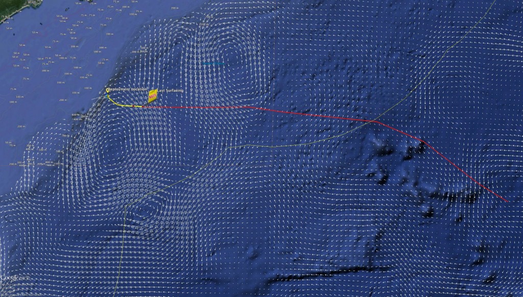
Today we have one of those rare occurrences where not only do the models match up quite well, but in a pretty favorable fashion.  Both forecasts seen below (RTOFS in green in the first image and Copernicus in yellow in the second)  show a warm eddy and cold eddy combination about 300km to our south east that will be aiming for over the next week.  They also agree that if we keep our heading a bit to the south along our approach we should find more favorable currents along the way.  With our current waypoint, Challenger should progress somewhat along the white line shown in the images if the forecasts hold true.


RTOFS Currents for July 16.  Average of 300, 600, 1000m

RTOFS Currents for July 16. Average of 300, 600, 1000m


Copernicus Currents for July 16.  Average of 300, 600, 1000m

Copernicus Currents for July 16. Average of 300, 600, 1000m


Tomorrow morning after our pre weekend discussion we will set a new way point further out to the south east to pursue through the weekend as we try and hit the sweet spot between those two eddies.


Force Wind Sea & Honor
Four Paths


Now two weeks into our mission, the team has been looking forward to which path we will take in the coming months on 29s trek to South Africa.  Our dear friend Antonio laid out four possible paths we can take:

ru29 paths


Each of the paths stretch between 5500 and 6000km which will last around 245-280 days. The differences in the path options appear during the first 1/2 of the mission upon reaching Tristan de Cunah.  This mission will be the longest of 29’s so far and the small secluded UK archipelago is the only port available to us along the way.

Later, after crossing to the north of the EEZ of Tristan de Cunha, the paths merge as piloting shifts to jumping from eddy to eddy as they pass around the Cape of Good Hope, leading Challenger back to Cape Town.

ru29 paths 2

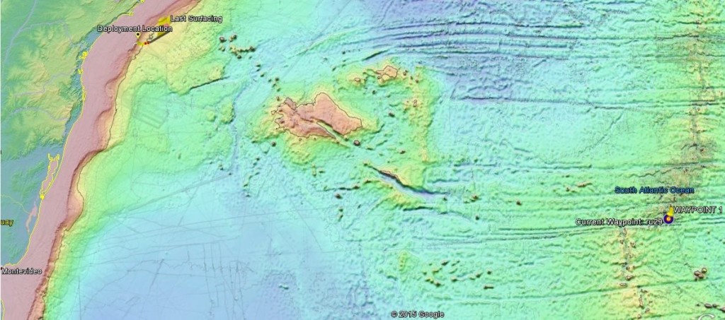
Antonio also provided us with some nice 3D imagery of the bathymetry.  Featured in the image above, is a region of sea mounts and volcanos that are jutting up from the seabed. Going forward, we plan to pass to the north of the mountains just ahead of us before snaking our way to the south.

Looking to the forecasted currents, we have an interesting conflict to our south east.  In the image below, black vectors represent the copernicus currents at 300m while the white currents are RTOFS. 11700994_10204590590668138_1552356346400540371_o

Both forecasts show an eddy signature to the south east, however copernicus defines it as a clockwise cold core eddy while RTOFS shows it as a counterclockwise warm core eddy.

Both forecasts however show a prominent southern current a head which we plan on catching over the next few days.

Force Wind Sea &  Honor
July 2nd: Leaving the EEZ

Now at sea for just over a week, Challenger is continuing to fly strong as ever.  Just over 250km into the roughly 6000 km mission, the glider has been covering between 27-35 km/day while using a minimalist 2.16 amp hours/day.  At this rate, we should be able to squeeze about 350 days out of the battery packs as 29 weaves her way across the South Atlantic.

Ru29 about to cross into international waters With this afternoons surfacing, Challenger popped up roughly 5 km from Brazil’s exclusive economic zone, so early tomorrow when she next surfaces, 29 will once again be in international waters; the first of many mile stones for the new trans-atlantic mission.

Copernicus currents at 300m

Copernicus currents at 300m

For the past few days, 29 has been riding a nice tail current as she made her way down the eastern edge of a cold core eddy.  However looking at the latest surfacings, the currents reported by the gliders calculations have been showing the slowing of the tail current as we pass off from one eddy to the next as seen in the image above of the Copernicus forecasted currents for 300m depth.  In order to change the angle Challenger is flying at to catch the more favorable currents eastward, I moved the waypoint a few degrees to the north.  With this adjusted flight path, she will now take a more favorable path to the north of the cold eddy to the east as we fly over the seamounts that lie ahead.  Below is a path we hope to fly outlined in red as Challenger snakes her way through the terrain.

ru29_bati_0702


Force Wind Sea & Honor
Deployment pictures and Weekend Update

Challenger is now 3 days into her mission to connect the shores of Brazil and South Africa as she completes the circumnavigation of the South Atlantic. This will be the longest leg of the mission, however our team is confident we are up to the task.

RTOFS Model of Surface Currents and Sea Surface Height of the South Atlantic

RTOFS Model of Surface Currents and Sea Surface Height

Based on our ocean model road maps and the bathymetry that lies ahead, we hope to fly a path similar to what is outlined below with the red line.  The figure below shows 29’s position as of this afternoon overlayed with the Copernicus (formerly myocean) ocean forecast data for roughly 350m depth.  The recent forecasts are showing the signature of a large counter-clockwise rotating warm eddy to the south west producing the strong northward push the glider is reporting in her calculations of the currents.  The way point is currently just to the North of the island of Tristan de Cunha well off to the South East, but combined with the eddy’s flux to the north-north-west the glider is flying nearly due east.

Copernicus Currents from ~300m depth

Copernicus Currents from ~350m depth

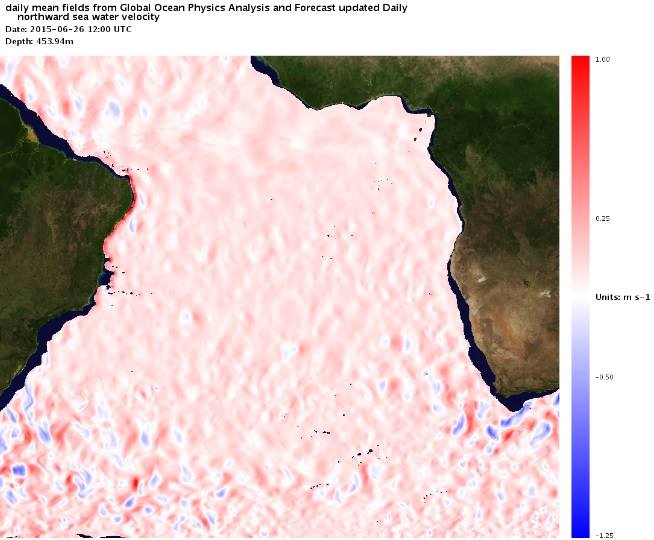
Looking ahead, Antonio provided us with a neat plot of the northward component of the currents of the South Atlantic.  In the figure below, red signifies northward components of the current while blue represents a southern flux.  There is an overwhelming overall flux to the north, however we will be doing our best to snake our way through the patches of blue and white as we aim for the southern edges of the counter-clockwise warm eddies and northern edges of the cyclonic cold eddies of the South Atlantic

Northward Flux of the South Atlantic June 26

Northward Flux of the South Atlantic at 450m June 26

We also must keep an eye on the bathymetry that lies ahead as there are some significant sea mount formations that we will encounter as we fly to the south east.  In the map below of the sea floor,  the black line depicts roughly the 1300m isobath.

Bathymetry of the South Atlantic

Bathymetry of the South Atlantic

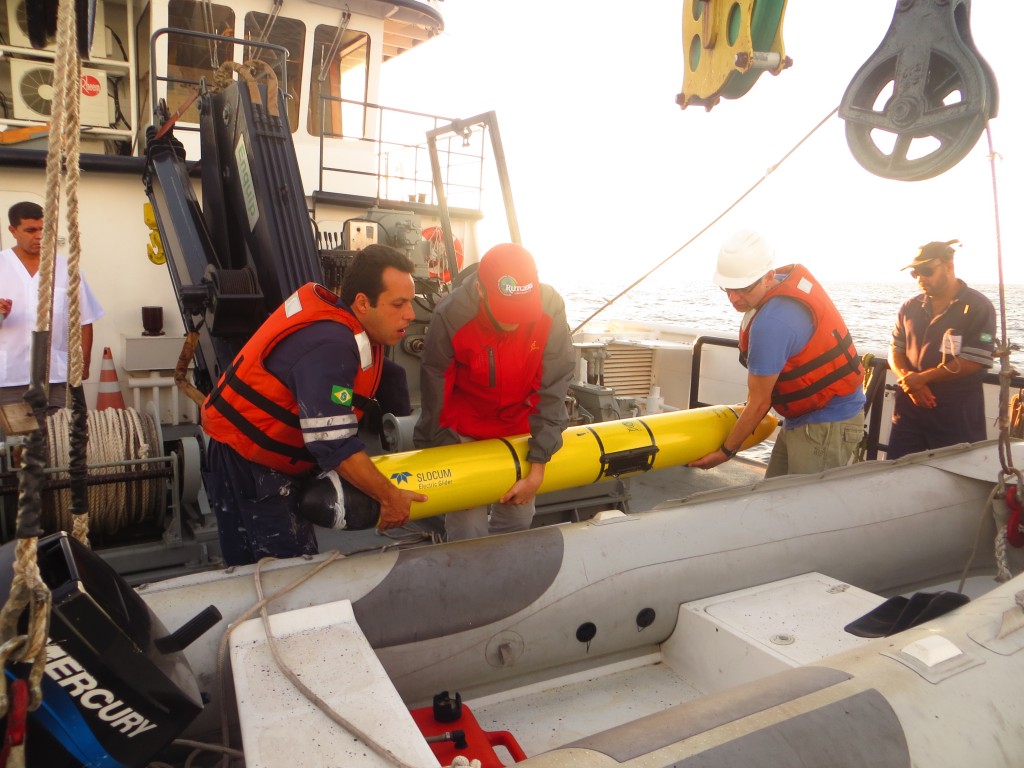
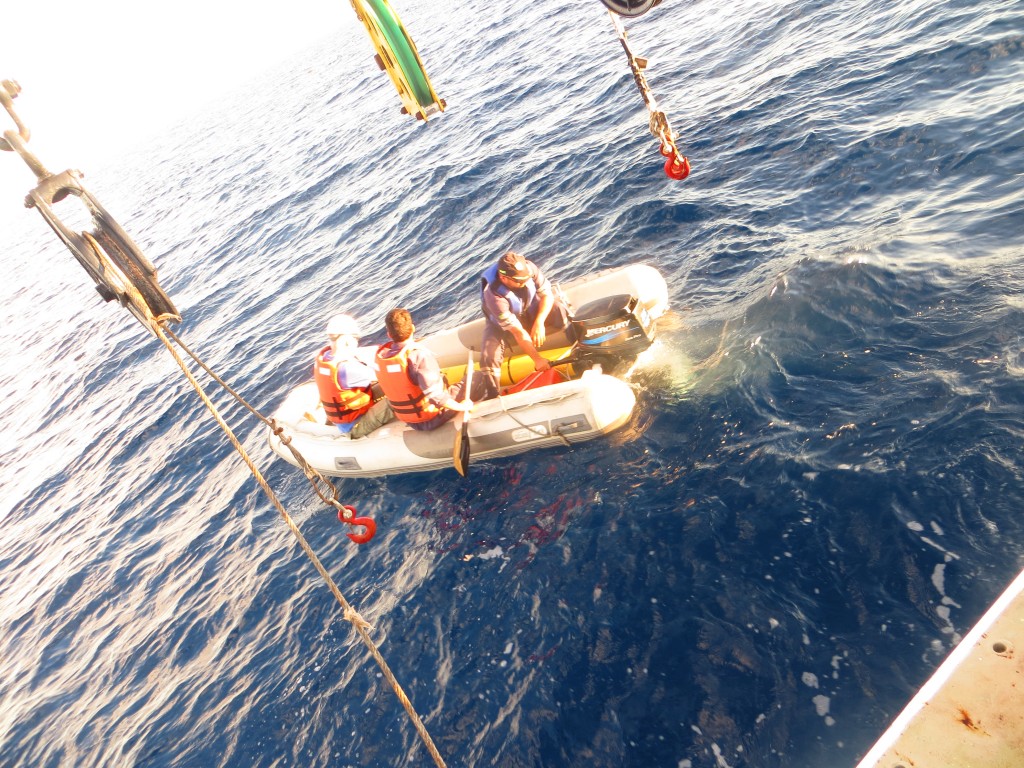
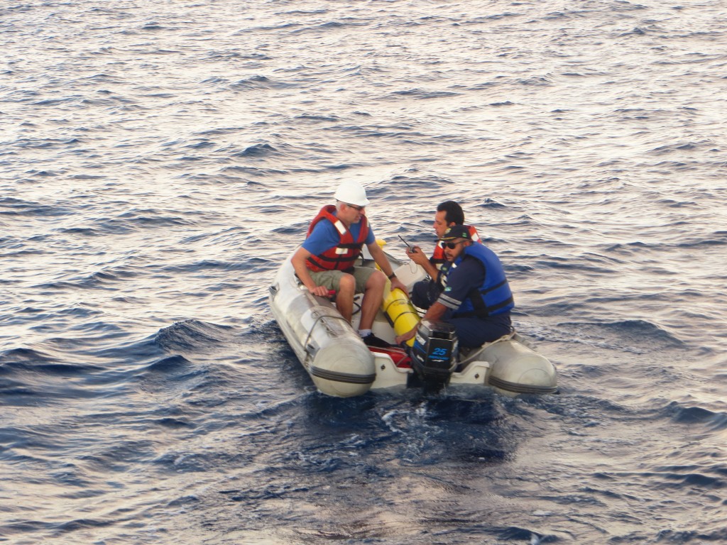
Finally, the following are pictures taken off the coast of Brazil earlier this week while Dr. Marcelo Dottori and his team deployed Challenger

IMG_4202

IMG_4237

IMG_4240

IMG_4244

IMG_4252

IMG_4261

IMG_4264


Force Wind Sea & Honor
RU 29 Back in the Water!

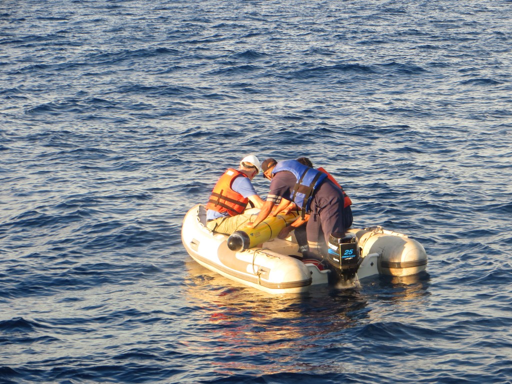
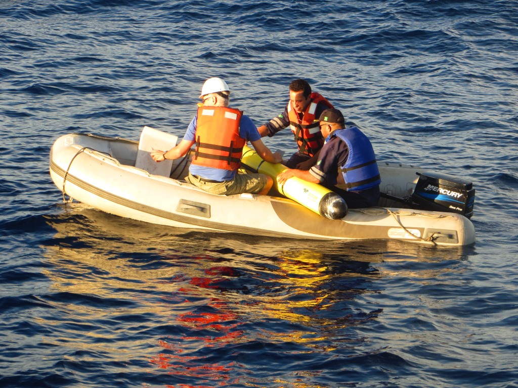
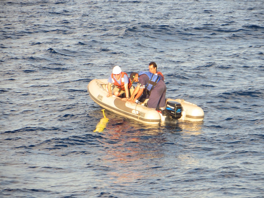
After a  long night of steaming out to the deployment location roughly 150 miles off shore of Ubatuba, Marcelo Dottori and a team from the University of Sao Paulo deployed RU29 at 5:46 this morning just past the 900m isobath.

ru29_deployed


After roughly a six month hiatus during which RU29’s hulls were brought back to the US to be replaced, Scott and Chip traveled down to Ubatuba towards the end of May to put the glider back together and run some initial tests while the glider was on land.  Then Marcelo and his crew prepared for a window of opportunity where they could safely get out to the deployment site and remain on location until a number test dives could be done to make sure Challenger was flying well before turning back to shore.  Dave was then able to run the deployment while remotely contacting Marcelo and controlling the glider from New Jersey.

DSCN3525

So far the glider looks to be flying well and is 6 hrs in to a 9 hr mission to 1000m  during which she will complete 3 full dives.  Tomorrow we will update everyone further as we get more information back from our team

Force Wind Sea & Honor
Returning to Sao Paulo

Hey Guys

just a quick update as we head into the Thanksgiving festivities- Challenger was picked up off of the Brazilian coast by a team from the University Sao Paulo aboard the Alpha Delfini earlier this evening.  The operation was coordinated by David Aragon back at Rutgers and Marcelo Dottori from the lab at the University of Sao Paulo.

In the coming days, our friends in Brazil will work with Dave remotely as the glider is opened and the search for the cause of the leak commences.

Force Wind Sea & Honor
Turning Back towards Shore

After roughly a day and a half at sea, Challenger reported back with one of the worst messages possible (second to no contact at all that is): an abort triggered by the leak detect.

turning_towards_shore

Similar to the previous deployment in July out of Santos, RU29’s leak detect mechanism was triggered at depth resulting in the glider returning back to the surface to report on the matter.  David Aragon then spent a significant amount of time running tests on the glider resulting in the decision to turn the glider back towards shore.

29 will now spend the weekend weaving her way back to the North West, where early next week a team will depart from the University of Sao Paulo, recover the glider, and report back to us on the gliders condition so we can than make further plans from there.  But we will have more on that next week as the events transpire.

On another note, the images from the deployment of RU29 and USP03 are now online! Below are a select few but the full set can be viewed on our flickr page

Marcelo Dottori (U. Sao Paulo), Antonio Godoi (U. Sao Paulo), David Aragon (Rutgers), Chip Haldeman (Rutgers), Maisa Santos (Brazilian Navy), Scott Glenn (Rutgers), RU29 and USP03 in front of the Instituto Oceanografico, University Sao Paulo

Marcelo Dottori (U. Sao Paulo), Antonio Godoi (U. Sao Paulo), David Aragon (Rutgers), Chip Haldeman (Rutgers), Maisa Santos (Brazilian Navy), Scott Glenn (Rutgers), RU29 and USP03 in front of the Instituto Oceanografico, University Sao Paulo

Close up of USP03

Close up of USP03

RU29 completing a test dive

RU29 completing a test dive

Force Wind Sea & Honor
Ready Player One

After months of sitting in pieces being worked on in labs ranging from the University of Sao Paulo to Teledyne Webb Research and Rutgers University, RU29 is back in the game.  David Aragon and Chip Haldeman spent roughly a week down in the USP facilities after gathering up all of her parts, where they then assembled Challenger and prepared her for her next mission- a feat that wouldn’t have been possible without the help of our friends at both the university in Brazil and at TWR.

ru29_rora

Early Monday morning (Nov 17, 2014), the boat departed Ubatuba around 5:30am (2:30am EST) and within a few hours the glider was deployed amongst the rolling swell of the sea, off of the Southern Brazil Bight.

ru29_breaching

Now following the line dubbed the Ilhabela Line (Native for Beautiful Island after the island near to the deployment team’s departure point), Challenger will fly across the shelf before we eventually hit deep water and aim our sights on Cape Town.

ru29deploymentline

ru29_chip

ru29


For video of the deployment and initial test, click here

There is also some great news from our friends at Teledyne Webb Research on the other Challenger Mission Glider, Silbo.  After drifting at the surface for roughly 72 days and being rescued by fisherman off the coast of Barbados in August of 2013, Silbo has undergone a lengthy refurbishment process during which amongst a number of other upgrades, he has received a new pump and thruster system.  Soon he will be deployed for an off shelf test out of Woods Hole, Massachusetts where the new rig will be tested thoroughly before we set forth on the next North Atlantic Mission: spanning from North America across the northern region of the ocean basin towards our partners in Ireland and the United Kingdom and eventually Svalbard, Norway.

Force Wind Sea & Honor
« Older posts Newer posts »