Salinity is the story

RU29 is back in international waters.  As we move south, the warm layer of surface water is getting warmer, and is a bit deeper than earlier in the mission.


But the real story is in the salinity.  The subsurface salinity peak.

Thinking we should find us a RAMA buoy as we approach the equator.

Powering up the Thruster

After getting swept south earlier this week by a large eddy sitting off of the coast, our engineers implemented a well timed thruster test to try and help 29 further west towards more favorable currents.

screen-shot-2016-11-16-at-3-05-41-am

By running the test, we not only managed to push the glider into what evolved into more favorable currents, but we also managed to get some valuable metrics for power consumption.  By running a 13 hr mission with the thruster running at 40% power and 20˚ pitch, the glider burned energy at a rate of 4Amp Hours/day while increasing the gliders speed from 27 km/day to 37 km.

pasted-image-at-2016_11_16-07_52-pm

As we are now in more favorable currents as we make our way around this large cold core eddy, the way point is being pushed to the north west to 32˚15S, 110˚ E.  This will give us good position to continue westward to the point at which we can then comfortably turn northward en route to Sri Lanka.

Force Wind Sea & Honor


Swept South

Through the weekend RU29 continued westward off the shelf and towards the way point at 32˚S 110˚W

ru29nov14

With current correction turned off, 29 was swept south along the edge of the cold core eddy shown above in the OSCAR visualization.  Over the next week or so, Challenger will continue along this path as we make further progress west before we can turn 29 to the north and on her way towards Indonesia.

Force Wind Sea & Honor

Make Shift Coms with Silbo

After nearly 12 days of being missing in action due to a communications error, the guys up at TWR managed to keep tabs on the whereabouts of Silbo via the Argos Transponder in the tail of the glider.

silbonov12

Silbo we think is in pursuit of either the way point shown in the image above, or one further along the way towards the UK.  We are getting gps hits from the argos every few days so at the next connection we should get a sense of whether the glider is circling the current one as we get pushed by the currents or if it is heading on towards the next one.  For now, the only way to get back control of the glider is for the glider to reset which will kick the communications back in.  Based on how the mission has gone, one of these resets happens every few months, so hopefully by the end of the year we will be able to get Silbo under control once more.

Force Wind Sea & Honor

Friday Afternoon update

As we head into the weekend, RU29 is set to continue to pursue the waypoint as we make our way west towards 32˚S, 110˚E.  The glider was set nearly into her long duration parameters as we are now free of harmful bathymetry and so now diving to full depth, current correction turned off and set to sample on just the initial dive and final climb of the 4 yo segment.

ru29nov11

Force Wind Sea & Honor

Pushing West

nov8

With the currents continuing to push to the North/North East, we have left Challenger to chase the way point due west as we cut across these strong persistant currents.  On our last surfacing, Challenger had made good progress covering over 10km in the process.

2016110806

Now that we are nearly off the shelf, we have the glider sampling to full depth as we prepare to set our sights on Sri Lanka

ru29_20161105t0137_20161108t1524_sea-water-temperature_ts_lvl2_lores

Force Wind Sea & Honor

Wrong way!

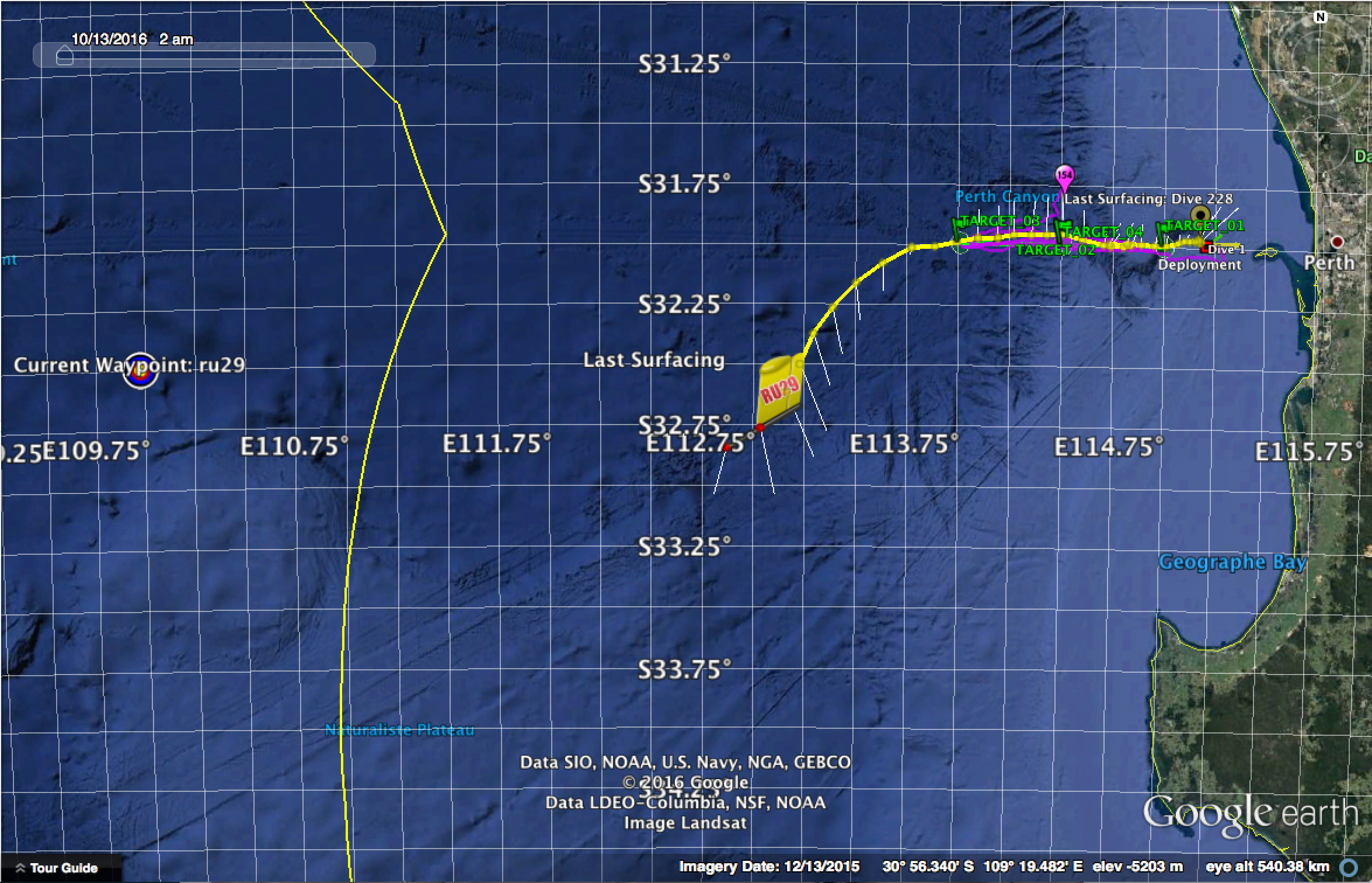
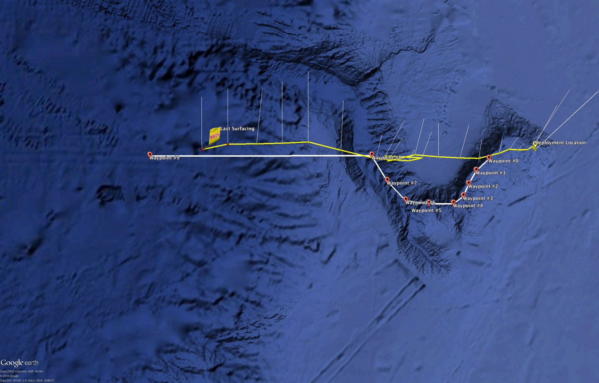
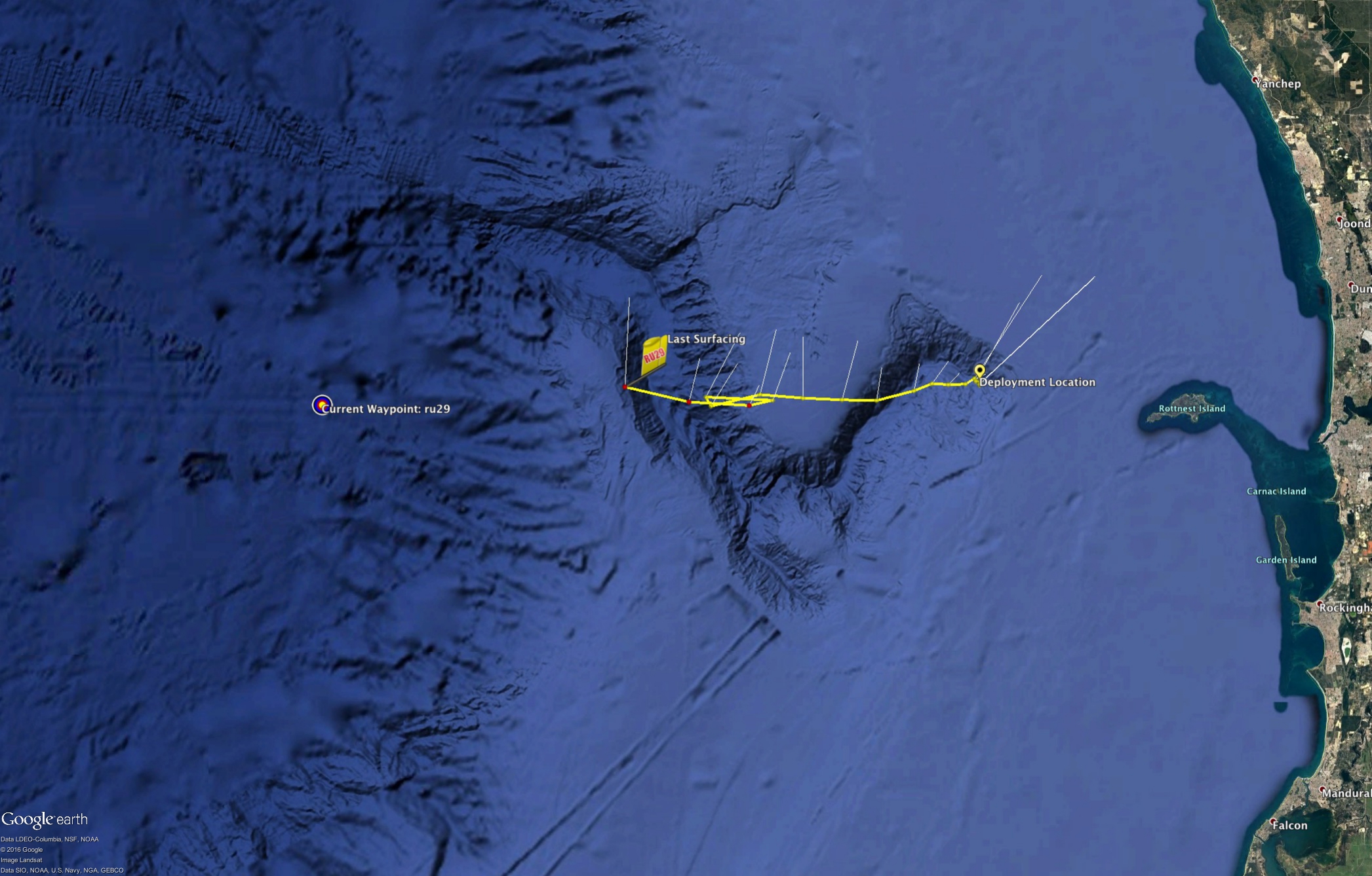
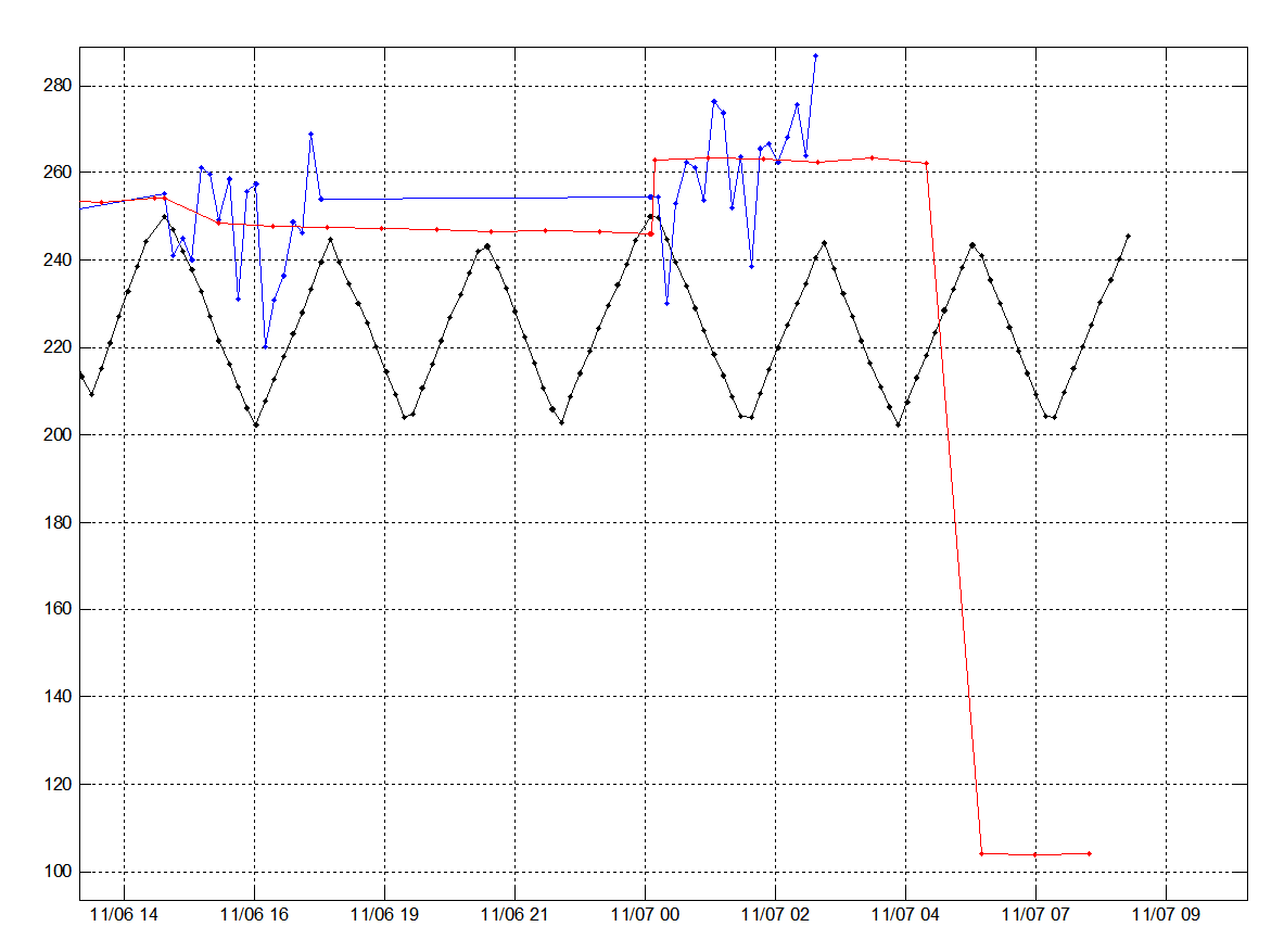
Due to a mis calculation in the distance to the way point, this morning 29 turned to back to the East to pursue our emergency way point off of Perth.

pasted-image-at-2016_11_07-12_33-pm 
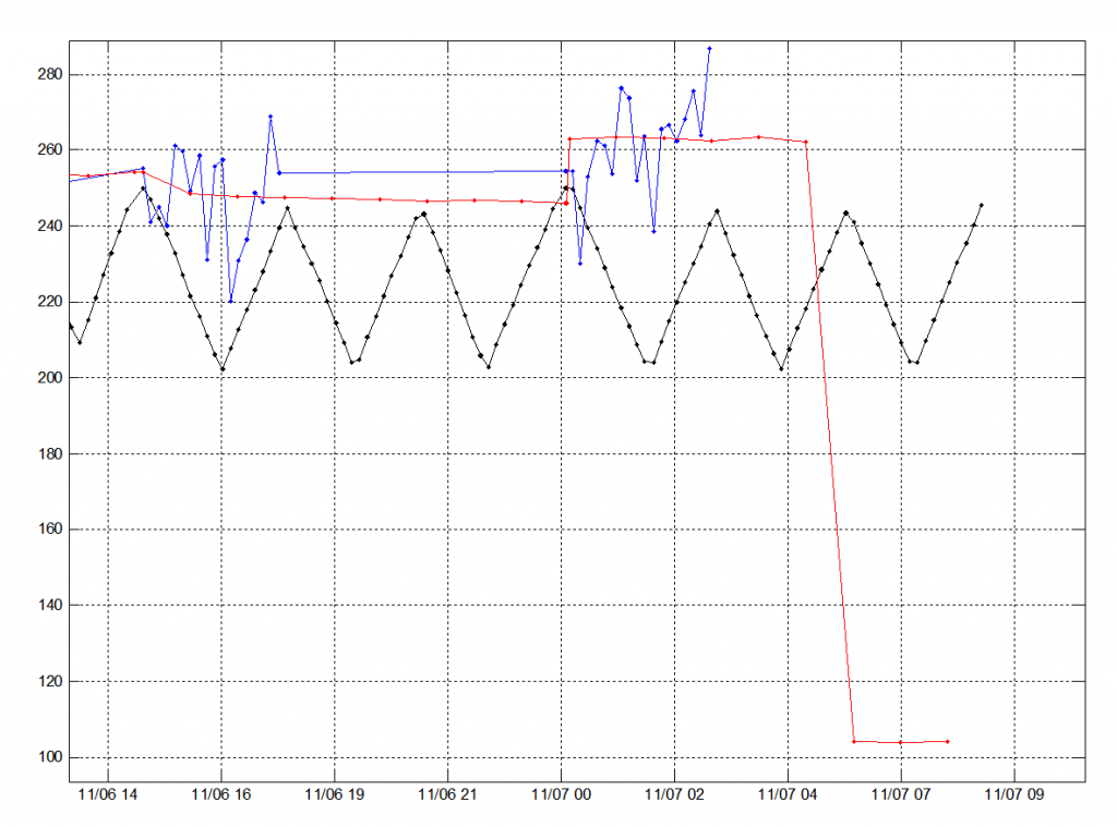
In the image above of the gliders heading, the line in red shows that as the glider was preparing for the last ‘yo’ in its segment, it calculated that the way point was much closer than it actually was, and so since it believed it achieved that way point, began to fly towards the next way point which was left in the direction of Perth as a safety protocol.

291107evening

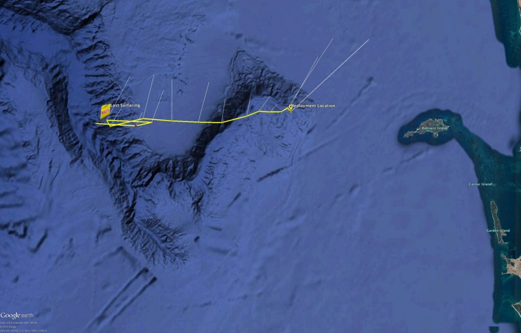
Our pilots however have since gotten the glider back under control and have sent it back on its way to the west.

2016110622

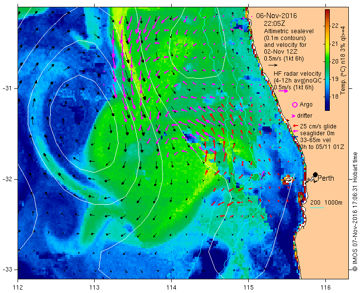
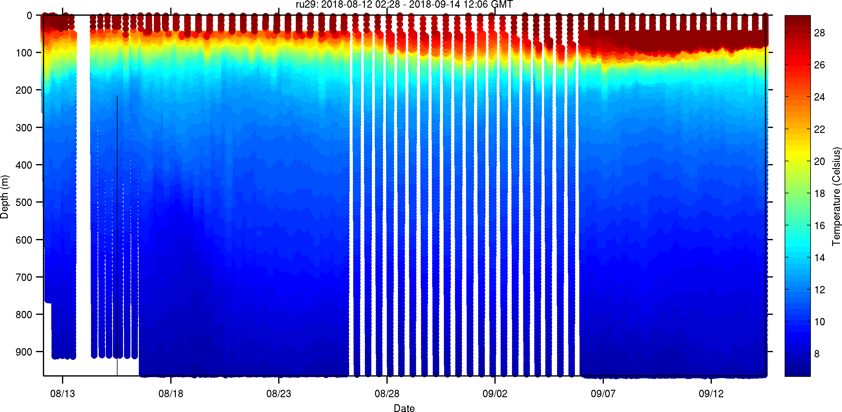
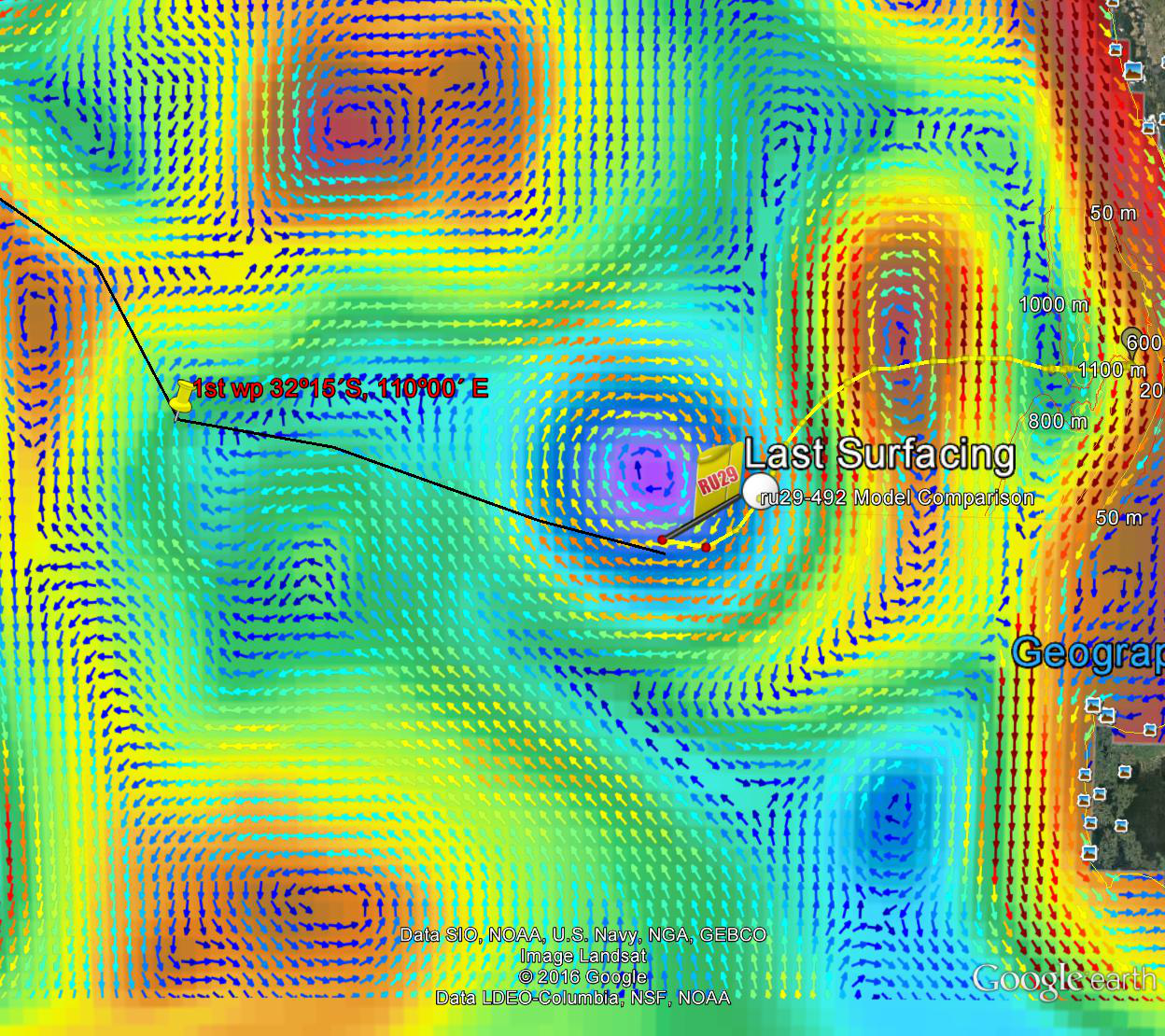
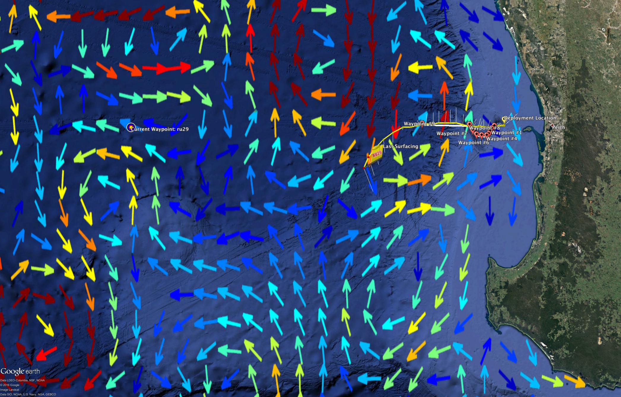
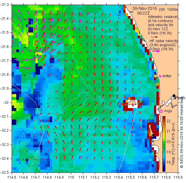
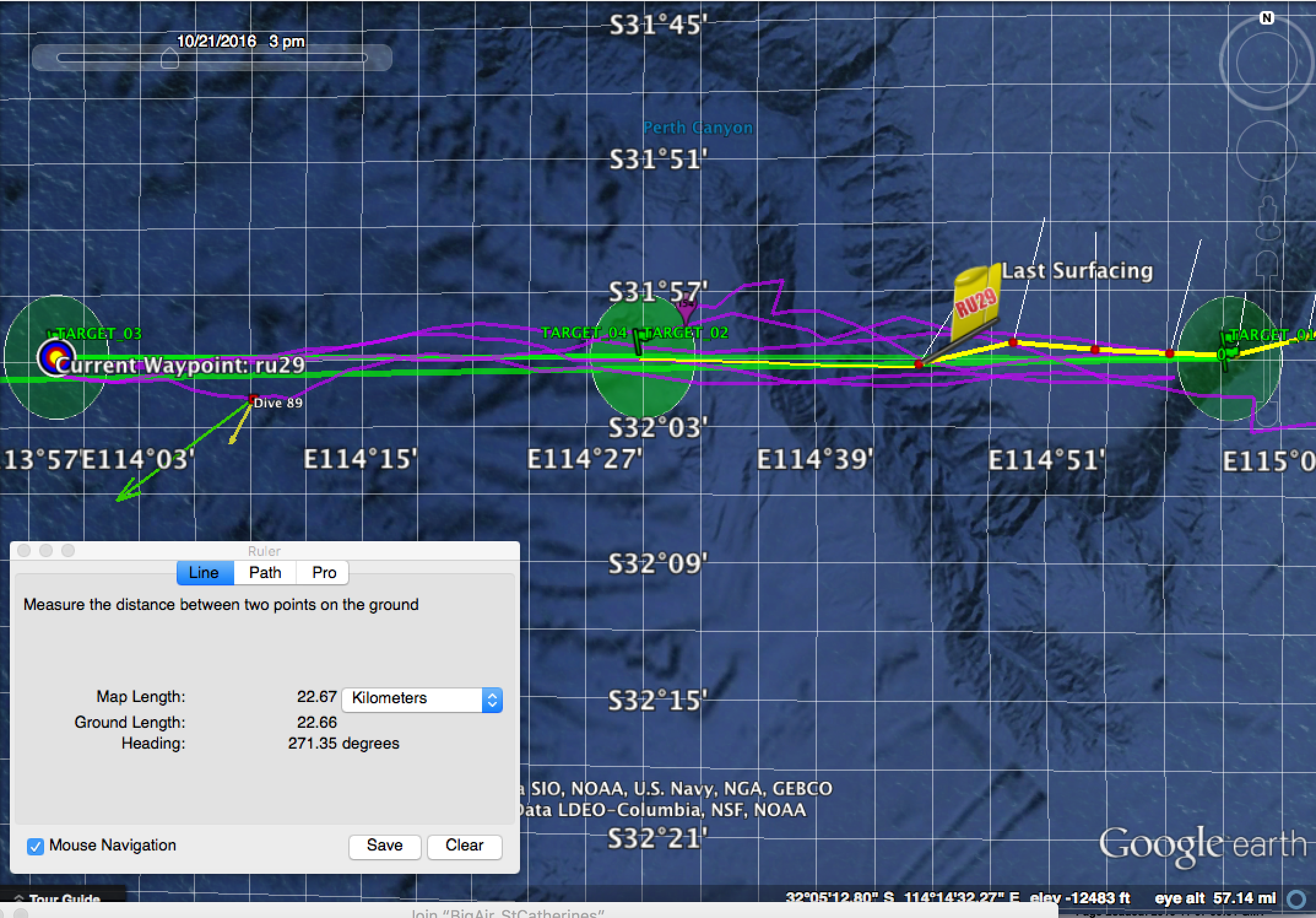
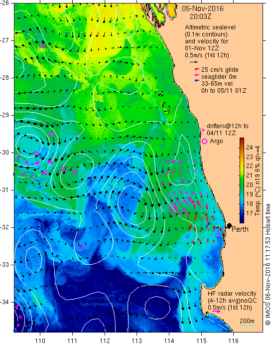
Looking at the currents from IMOS, as we continue down into deeper water we will see the flux to the north, however once we cross the deeper isobath, the current curls around and flows to the south west.  Our partners in UWA have told us that their Sea Glider is only about 20 nautical miles ahead of 29 and that we should have no trouble catching up to still pull off the calibration check.  Until then we will continue to fly towards the western Way Point.

Force Wind Sea & Honor

Chasing Sea Gliders

As 29 continues to progress across the shelf, Dave has it chasing a UWA Sea Glider that was also deployed.

screen-shot-2016-11-06-at-7-20-15-pm

Over the next day or so we should catch up to the sea glider where we will then fly in tandem and be able to compare data from both gliders as a calibration check.

ru29_20161105t0137_20161106t1459_sea-water-temperature_ts_lvl2_lores

In the data plots, we can see that we are nearly capable of flying to full depth of ~950m.  Soon we will be free of the harmful bathymetry and able to settle in for the long term flight parameters.

Force Wind Sea & Honor

Photos from the Deployment

The following are images taken during the deployment of Challenger for the Indian Ocean Mission.

dscn3516

RU29 entering the water

RU29 at the surface

RU29 at the surface

Chari and Dennis from UWA are on the deployment vessel.  Chip is in the water photographing RU29

Chari and Dennis from UWA are on the deployment vessel. Chip is in the water photographing RU29

Currents from the Integrated Marine Observing System

Currents from the Integrated Marine Observing System

Through the remainder of the weekend, 29 will continue to fly westward across the shelf and into the basin before we make our turn to the North

Force Wind Sea & Honor

« Older posts