Page 11 of 37

Mysterious Eddy Structure

There has been quite a buzz amongst the scientists down in Brazil as 29 makes her way south along the shelf.  The region we are presently flying through is notorious for eddy formation and researchers are keen on looking at the data as Challenger makes her way through the region.  Last week, looking at the models it seems we may have cut our way through the position of a potential eddy while we may be on the verge of entering a new one.

Looking at the forecasted structure of the water column, in the top few hundred meters there appears to be a strong clockwise spinning eddy while at depth there is a northward jet flowing along the shelf when inquiring the MyOcean model.  The RTOFS model on the other hand shows a counter clockwise spinning eddy at depth to the south east of the gliders location.  The eddy most evident in the surface layers of the MyOcean model will be a prime subject to delve into in the coming weeks.

Force Wind Sea and Honor

Positioning ourselves for the Crossing

ubatuba_approach


With just 500 km remaining between RU29 and the port of Ubatuba, our team is working to pull all of the moving parts together to make this mission a success.

By the mere luck of the draw, Dr Frederico Brandini of the University of Sao Paulo colleague of Dr Marcelo Dottori who will be the Chief Scientist running the recovery operation for 29, is on sabbatical here at Rutgers.  Brandini gave a fascinating talk highlighting his work at the University with ecosystems along the Brazilian shelf break that our team was eager to attend.  One topic discussed was the immense fishing that takes place along the South Brazil Bight- the northern portion being where the recovery is being planned.  After the talk he met with our team where he was able to point out where the main shipping lanes were and helped us plan our approach.

april19

In the image above we can see the result of the meeting being the red line which leads from Challenger’s latest location south along the shelf and then crosses the shelf perpendicularly and makes a B-line in to port.  At the University of Sao Paulo, they have a budding glider program that will soon be monitoring the coastal waters of their region.

In cooperation with their program, Brandini and our team planned the location of that B-Line to be the foundation of a future long term survey to be run by gliders- similar to the Endurance Line that we have run off of New Jersey for over a decade.  If all goes according to plan. Challenger’s final approach into Ubatuba will be the first of many glider runs along that line.

As for the conditions forecasted around our glider now, At the surface both models are showing evidence of a cold eddy to our south and warm eddy to the north creating the strong flux at the surface that is confirmed by the surface drift seen by the glider.  Subsurface however, RTOFS shows that there is movement northward in the water column that MyOcean doesnt pick up .  This push north seems to hold true when compared to the depth average current calculated by the glider showing an overall northward resistance.

Force Wind Sea & Honor


Crossing the EEZ

They Shoot! … and they miss.

eez

We can’t win them all, but the important thing is that Challenger has officially crossed the Southern Atlantic, the first complete crossing of an ocean basin in nearly 5 years!

approaching_ubatuba


Looking ahead, we are planning on flying a path roughly 750 km towards the port at Ubatuba. As of right now we are not sure what sort of boat will be available to us for recovery, so we will do our best to take care of our team taking part in the operations being led by members of the University of Sao Paulo, and get the glider as close as possible.  This way we aren’t waisting precious time on deck and will have more time in the lab assessing the condition of the glider and being able to make the necessary repairs for the following deployment.  For now, the plan is to still travel down to Brazil in mid may for the recovery and redeployment so we shall keep our fingers crossed as we navigate the final stretch into port and move the necessary equipment to our friends in the southern hemisphere.

Force Wind Sea & Honor

Aiming for the Trifecta

According to the currents being calculated by the glider, 29 has been seeing a consistent push northward throughout the water column.  This overall flux shows the currents at depth are strong to the north, redirecting our trajectory as we power forward towards shore. This flux we believe may be part of the Antarctic deep water that Antonio described during Silbo’s crossing from the Canaries to the Caribbean.  The presence of this water mass moving to the north is what we believe to be the reason why Silbo was unable to follow the intended path across the equator and into the South Atlantic and instead had to divert to the west.

This resistance however is not too worrying this time around as flying perpendicular to it is allowing us to make consistent progress to the west.  Last night we shifted the way point a bit to the south as we aim for our next goal: The Trifecta.

apr08track

The Trifecta that we are shooting for is as follows:

1. Crossing of the Tropic Of Capricorn

2. Crossing of the Exclusive Economic Zone of Brazil

3. Leaving international waters concludes our crossing of the Southern Atlantic Ocean Basin

trifecta


As we define the end zone, we look to the US and European current forecasts to see if we can attain our goal…

Looking at the currents, MyOcean seems to match more closely to what Challenger is reporting as it shows the entirety of the water column weaving to the north-northwest while RTOFS shows the outer edge of the near by eddies resulting in a flux to the south.


Force Wind Sea & Honor

Returning to the West

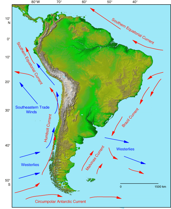
As we leave the home base of our sampling scheme for the last time, we have thrown the way point out to the north west.  As we get closer to shore, there is a danger of being swept to the south by the Brazil current shown in the figure below:


We have also heard that this current meanders quite a bit, so depending on where we catch it, the strength of the southward flux may vary.

MyOcean’s forecast today has a pretty cool looking eddy field within our vicinity. In the upper layers, there are two well defined eddies to our east and to the north west that can be seen through 300m.  Below that, the eddy to the east fizzles out while the one to the north west weakens with depth.  In the RTOFS model, the main feature of interest is the eddy to our West-Northwest that lies within the path we plan on flying towards the coast.  Depending on how fast this eddy moves we may be able to dissect it in the coming weeks.


Force Wind Sea & Honor

Criss-Crossing the Tropic

Last night Challenger completed another mile stone as she crossed the Tropic of Cancer for the second time since being deployed- however she quickly jumped back to the north as she followed the path of our final wing of the eddy sampling mission.

apr01tropic

Over the next few days she will fly in towards the center of the fan for the last time before we throw the waypoint towards the shores of Brazil and begin making our final plans for recovery.

Looking above at the gallery for the currents today, there is a drastic contrast between what the models are forecasting.  MyOcean is showing an overall flux westward throughout the entire water column that aligns well with the deep eddy that has been moving steadily to the north.  On the other hand, RTOFS is showing an overall flux through all layers to the south east caused by the lower left rim of the warm core eddy at the base of our sampling scheme as it meets up with another eddy to our north- possibly the same eddy present in the MyOcean model.


Force Wind Sea & Honor

Flying the Third and Beyond

As Antonio criticizes my flying by saying “my three year old nephew can draw straighter lines than that!!!”  Challenger pushes along the third wing of the windmill as we sample the eddy field within the area outside of the Brazilian Exclusive Economic Zone.

mar29track

Antonio also reports that it looks like the eddy has shifted out of our range of the sampling zone as the system moves to the north.  As we make our final pass through the area, we have Ru29’s course set to fly to the north west in preparation of entering the Brazil current which should carry us to the south west along the South Brazil Bight.

Dave lately has been running numbers on our engineering parameters for this flight in comparison to the mission from Cape Town to Ascension and Silbo’s crossing from Canaries to the Caribbean as those two missions done by Slocum Gliders of similar magnitude.  On our pump, we have done close to 12,000 inflections averaging out to roughly 17 per day meaning we should have about 470 days left.  We have also had a very low number of oddities from the sensor monitoring the pump and only a few on the previous mission.  This should be a good sign as while Silbo was in flight across the North Atlantic there were a number of oddities leading up to the crippling pump failure that left the glider drifting for the latter portion of the leg that ended upon recovery in Barbados in August 2013.


Looking ahead, this will most likely be our last wing of the windmill as we will begin heading in towards shore for our recovery.  The plan at this point is that a team will head down to Brazil May 12-22 to our Brazilian partners in the recovery. Being that we have just a month and a half before that window and that we would rather be safe than sorry, the feeling at base is that we are better off arriving with some time to spare and loitering off shore.


Force Wind Sea & Honor

On to the Second

mar22track

Upon Scott’s arrival from his visit with the University of Sao Paulo in Brazil, we were given the location that the final recovery operation will take place in: Ubatuba (designated by the house symbol on the map above).  The University has a field station there where after the recovery, the team will return there to work on the glider before redeploying within a short window of time.

mar22trackzoom

Challenger continues to kill time outside of Brazil’s exclusive economic zone (EEZ) as we finish the outbound portion of the second wing of the fan-sampling scheme. We will continue to fly a pattern like this for 2-3 more wings (averaging roughly 10 days per wing) as we await pending details on our recovery.

As for the currents, MyOcean continues to show the eddy most prominent at surface with lower layers continuing to flow westward.  There are also a number of eddies to the east of our sampling area. RTOFS shows evidence of the currents curling but not until 900m do we see the fully rotating eddy signature while there is one massive eddy signature now over the home base portion of the sampling area.  RTOFS also shows a beautiful full water column eddy sitting right at the center of our sampling region.


Force Wind Sea & Honor

Closing the First

It was an exciting week here at the Institute of Marine and Coastal Sciences because Sylvia Earle came to visit us to show support and help us celebrate our 10th Anniversary. Check out the write up on Sylvia’s Mission Blue page here.

As we begin to close the first wing, we have made some alterations to our planned sampling schematic:

mar16

Instead of flying the wind mill pattern as we had previously planned, we are now going to fly a fan pattern- going out and back to the starting point through the region of the eddy to our west.  This we feel is a safer pattern as we won’t move ourselves any further away from Brazil than we have gone previously.

Antonio also pointed out that if we look at the time series plots of the mission, over the past couple days, at depth there is a signal showing warmer water at depth- could this be a sign of the eddies?

mar162

Looking at the break down of the currents, MyOcean now only has the eddy to our west well defined at the surface while at depth it becomes a general flux to the east. RTOFS however now has the two eddies to either side of us (east and west) well defined throughout the entire water column


Force Wind Sea & Honor

Beginning the Wing

Now with just 700 km between RU29 and the shores of Rio, and with more than 2 months until there’s even a hint of a chance for a recovery, we have sent Challenger on an eddy hunting mission.

mar12

As we mentioned previously, Antonio made a fascinating discovery of strong subsurface eddies reaching velocities of up to <30cm/s!  Upon further inspection we found that there were actually a number of different eddy signatures in the area and so we set out to create a sampling strategy.

mar12

Over the coming weeks, we will take RU29 and fly the windmill sampling pattern through the area in order to take a look at the structure of the water column and see if the gliders calculation of currents supports or denies the claims made by the forecast models.

Looking to the forecasted currents in our area, both models are showing eddies that appear at depth that do not hold their formation all of the way up to the surface.  In MyOcean, there is the well defined eddy that sparked our sampling scheme to our east but also a smaller eddy to the west that is visible below 600m.  In RTOFS, there are two features of interest, the one eddy close by to the east that spans the entire water column being inspected, and to the west an eddy who we begin to see around 600m and starts to take shape by 900m.

Finally, yesterday at Oceanology International, Iridium announced their Sponsorship of the Challenger Mission, through which they will provide communication services to the Challenger fleet as the mission gets rolling. Read the official press release here


Force Wind Sea & Honor

« Older posts Newer posts »