Hey All!
So we are now just about 8 hrs away from leaving port on our way to recover Silbo!

At 7:30am (canary time, 2:30am Eastern Time) we will be meeting at the port as we make final preparations to head out and recovery after Silbo has been at sea for 238 days while covering 5555km! Silbo has been through probably more than any other glider, pushing the frontier as he sailed from the Arctic waters off of Iceland, fought his way against the gulf stream, took the Azores front head on, was tossed by over 50 storms, touched the edge of the Mediterranean outflow passed by sea mounts, dodged ships, surfed the Canary Current, and tasted the tongue of the Antarctic Intermediate Waters- and that is only the stuff we know of from on shore!
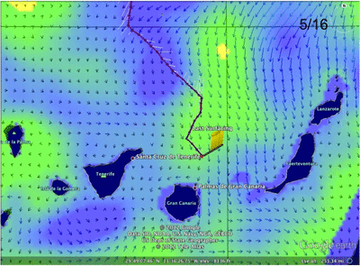
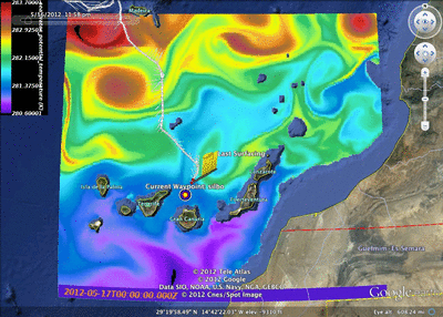
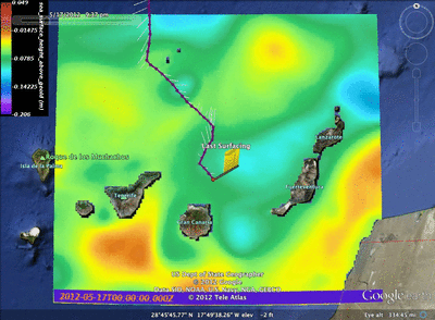
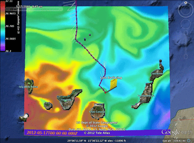
Today, our team met to make some decisions about where to recover. Over the past day and a half now, Silbo has been drifting to the east, so it was proposed by Antonio to move the wp west in order to correct for this and keep us out of the shipping lanes.

However, there is always more one side to the story, as we then looked at the activity of the currents from multiple models:

Comparing the currents derived by silbo, hycom and ncom, we had 3 different stories of what was going on. With this in the back of our minds, we also had to take bathymetry into account as we didnt want silbo running aground. Luckily, we have at least 20 km between Silbo’s location and any need to panic there.


So finally, as we cross our fingers and wait for the morning to come, we look into what the rest of the models are telling us about how the currents and remnants of eddies, broken up by the location of the islands, are dictating the movement of the waters around silbo.

Hycom Salinity

Hycom SSH
Another useful tool we have access to thanks to the ftp site created by our friends at ULPGC is making a gif allowing us to see the progression of marine conditions over a number of days:
Ncom/Nlom Currents and Sea Surface Height May 16-20
This can give us a ball park estimate of what to expect in the times to come.
Antonio also provided us with fascinating imagery of the regions showing the temperature, sea surface height and salinity over the last 5 days of the mission.
Sea Surface Temperature May 17-21
Sea Surface Height May 17-21
Sea Surface Salinity May 17-21
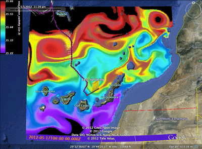
Salinity at 900m depth May 17-21
What is really outstanding is the purple and blue colors at the bottom of the last image showing the antarctic intermediate waters reaching up and interacting with the mediterranean outflow creating the spectacular design.
Tomorrow morning is going to be a long day, current forecast is showing seas of about 2.5m so it is going to be a bumpy ride on our little rescue boat. So I need everyone to pray for a flawless recovery mission and I will update everyone tomorrow with the news!
ps- Ru25, another deep glider owned by Rutgers, has been deployed off of the Azores and is ready to make its way up to Iceland!
Force Wind Sea & Honor!
Nilsen, Antonio & Lauren
Leave a Reply
You must be logged in to post a comment.