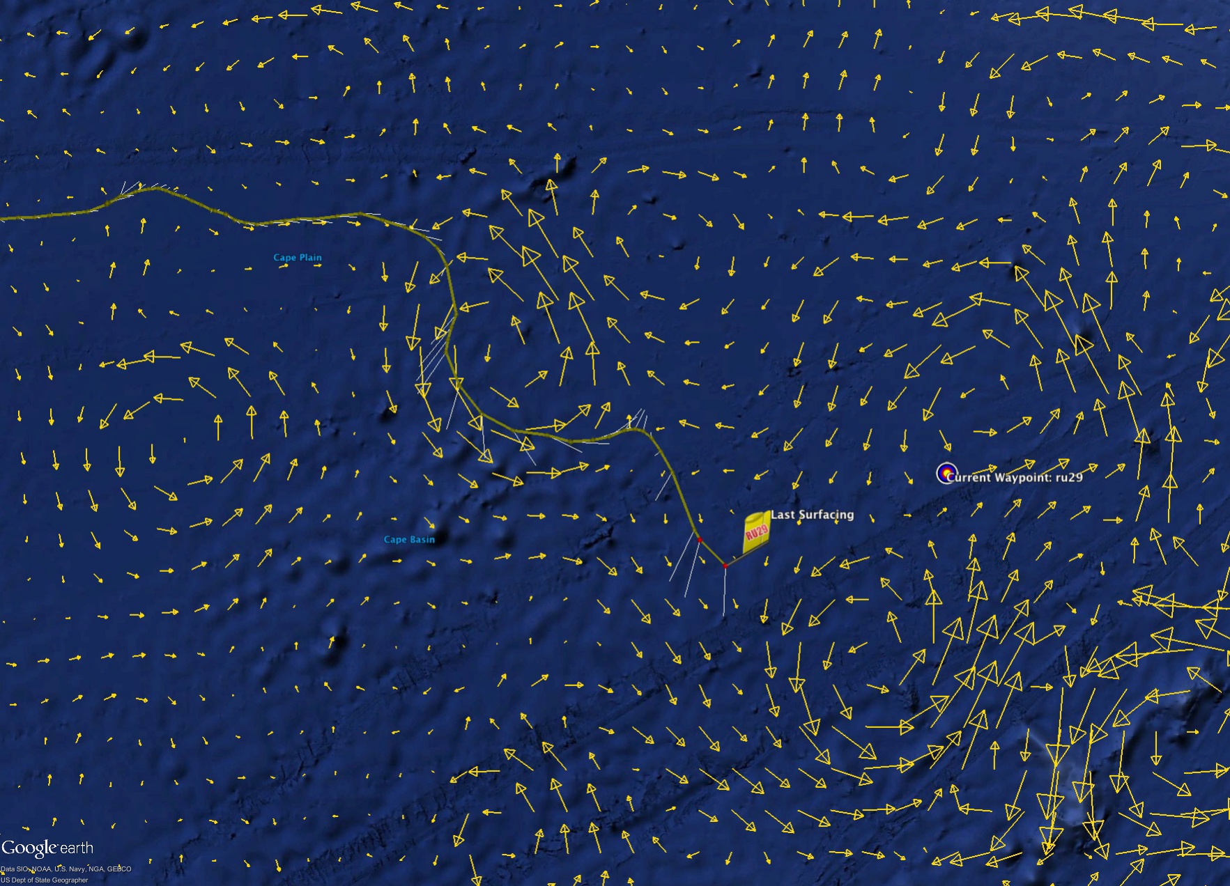
Over the past week Challenger blew through the eddy previously discussed and depicted by the copernicus model below. The european model nailed the forecast here and the currents predicted nearly matched the currents reported by the glider perfectly
Looking ahead, we have three options of routes to take to reach Cape Town. In the map below, we have the Copernicus forecast overlayed on NASA’s Jet Propulsion Lab’s forecast, OSCAR’s magnitude forecasts which both show signs of the eddy solar system which lies between the glider and the shore. Last night a new waypoint was set to our North East to try and steer the glider north of the large warm eddy to the South West. If this maneuver can be pulled off, we will then push along either the orange route or the magenta route in the map below.
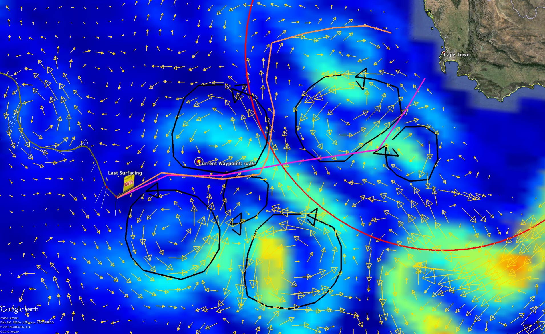
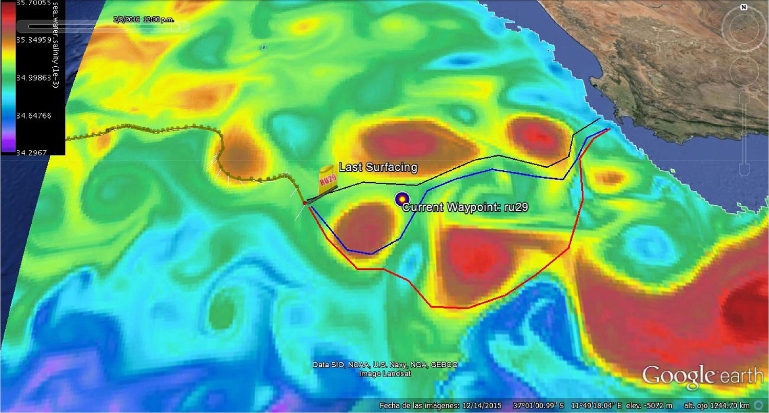
A third option is highlighted in the map below of the Copernicus salinity field provided by Antonio. If we are unable to get to the northern side of the warm eddy and end up being pushed south, there is a route that approaches Cape Town from the south, however this path is much riskier as it puts us dangerously close to the retroflection which threatens to throw the glider out into the Indian Ocean.
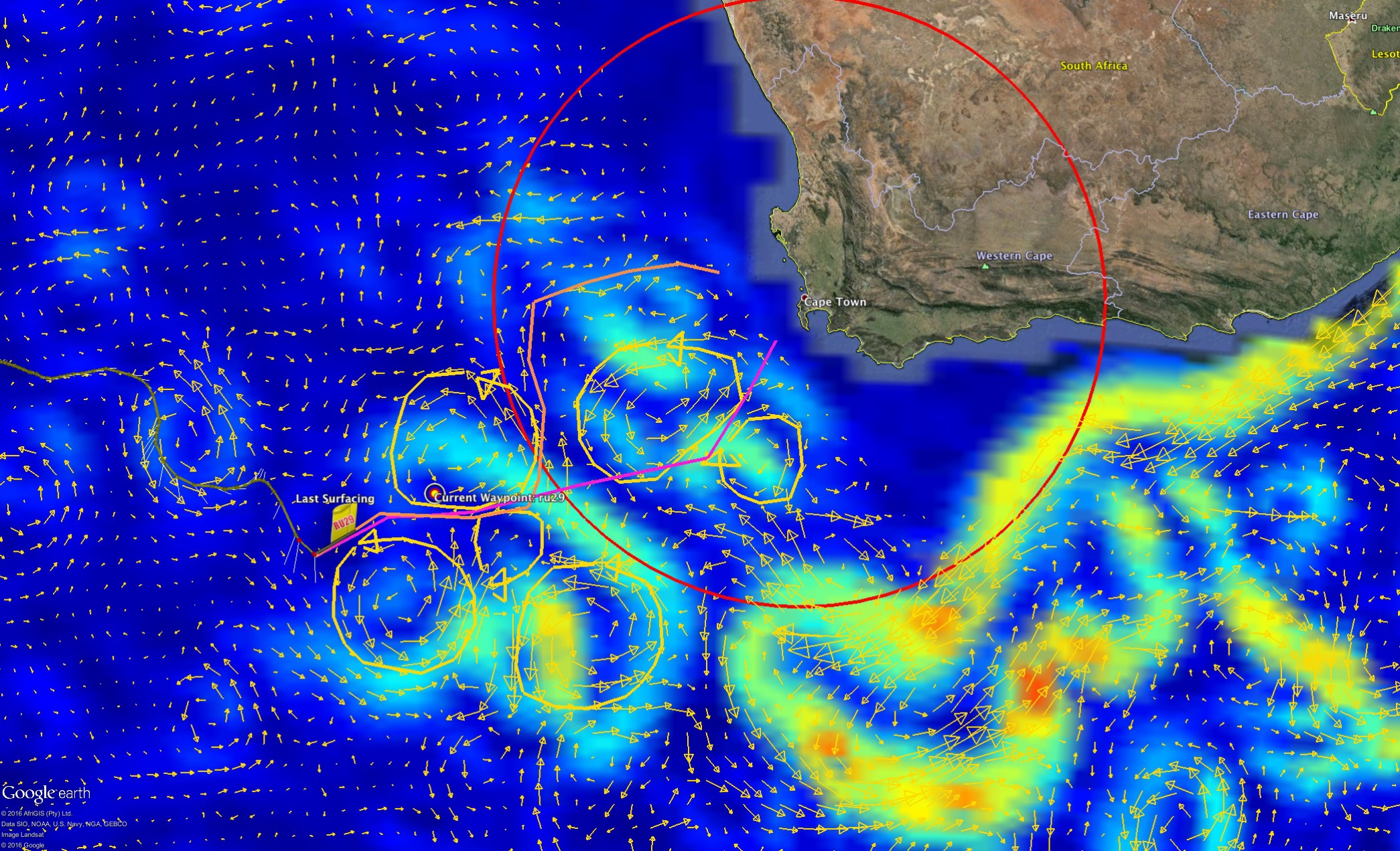
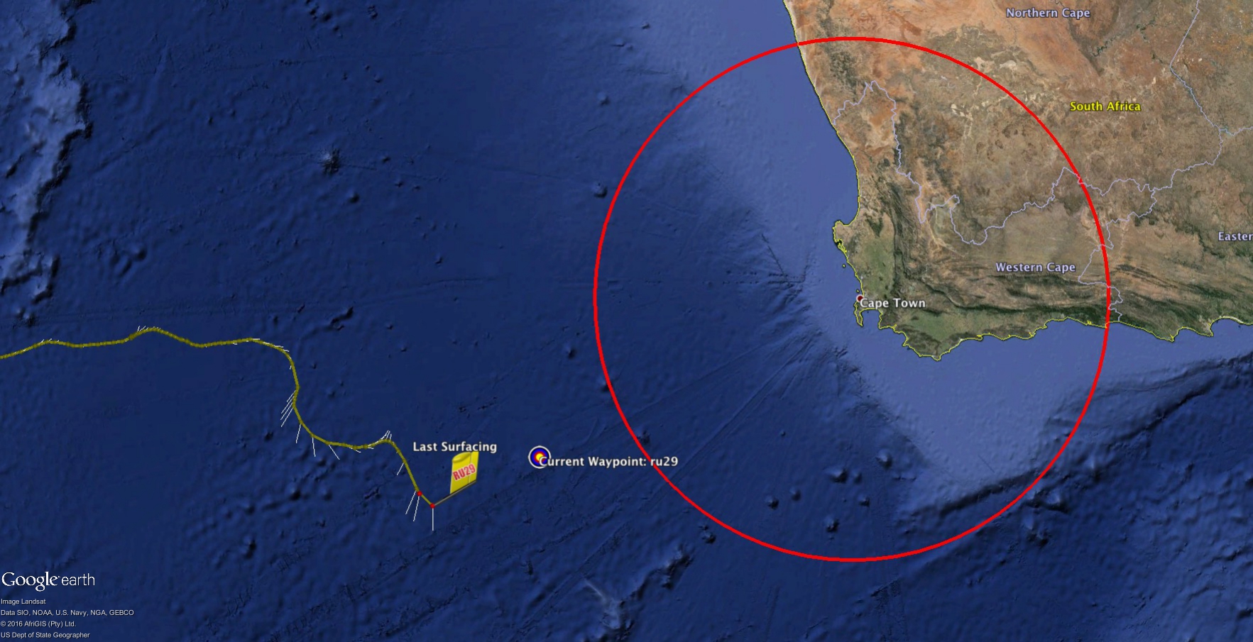
Finally, in the image below we have outlined the 250 nautical mile radius from Cape Town. This distance is important as it is the rough equivalent of how far a potential recovery ship could travel in a 24 hr period.
Force Wind Sea & Honor