Category: Challenger Mission (Page 26 of 37)

Challenger Mission

Opperation: Test Missions

Hey all,

Over the past two and a half weeks, 29 has been put through a number of test missions in an attempt to see if she is suited for her long duration flight as she kicks off the Challenger Mission in the upcoming months.

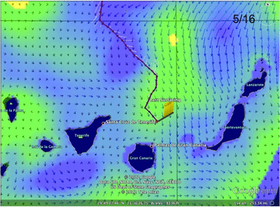
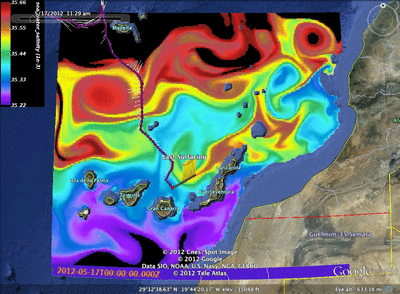
First off, we set the limits for our testing area.  Where we crossed the shelf, we were dealt an area bound by two large warm eddies, one to our north and one to the south, the Gulf Stream to our east, and the New Jersey Shelf to our west.

The test path we chose was to run back and forth in our test bed parallel to the shelf.  However, before we even had a chance to start our test missions, we found our first anomaly.

As we approached the way point before our turn to the North West, 29 mysteriously turned to the south even though the current was pushing us directly at our way point.  After further investigation, we discovered that this was due to the gliders thought process.  What had happened was that Challenger got close enough to the way point that given the strength of the current, she thought that she was going to over shoot the way point while on her dive.  Because of this, 29 aimed itself in the opposite direction as to fight the current that was helping us, thus causing the turn to the south.

As for the tests, we started off with making sure she is capable of diving the full water column.  This is done by stepping down, or pushing the depth we dive to gradually down over the course of a number of segments:

Once we completed this, the next on our list was to do a spin test.  This test sets the fin to one side and holds it there for the entirety of the dive.

By keeping the fin stationary to one side, the glider is sent into a spin as it dives and climbs.  In theory, the glider should then go down and come back up in the same location, but due to currents, both surface and subsurface, we drift.  Then by comparing the drift to the gliders calculation of the currents, we can measure the accuracy of the gliders calculation for depth average currents.  After completing the test, we found the error to be a little over 20˚ which was deemed acceptable.

Next we looked into some of the engineering variables needed to optimize flight for the gliders.  This included adjustments made to the placement of the fin offset, dead band, and gain with various combinations of the three to see which settings would be optimal for our missions. A full listing of the tests and results can be found here.

Our final test was to see if we could successfully inflect at depth.  This was proposed a few times over the course of Silbo’s flight from Iceland to the Canaries due to strong surface currents that were harmful while at depth the currents were more favorable.  So if we were able to make our top inflections at depth, we could minimize our time spent in the poorer conditions.

It was a success!  29 did two tests, one test with two dives between 100m and 400m, and a second test with dives between 200m and 400m.

Now that we accomplished a majority of what we wanted to test (also our batteries have run pretty low), we have set the way point back towards Atlantic City to try and cross the shelf before the weekend in preparation for a recovery early next week.


Shooting the Gap

Well, 29 is now officially crossing the shelf!

In the past 8 hrs the bottom has dropped from 500m to 1500m and will only go further as the day goes on.  We also have successfully passed between the canyons and so should be pretty safe for the time being

Nearing the Shelf Break

As of the last surfacing, Ru 29 is mere hours from crossing the shelf into the depths. We were cautious over the past day as we were trying to time our crossing of the shelf as perfect as possible.  Now that summer has started, fishing levels shipping traffic have spiked as people enjoy the warm weather.  Knowing that if we continued straight towards the shelf, we would arrive mid afternoon when the traffic would be at its highest.  So we decided to enter station keep mode to bide our time for a few hours so we could put off making the crossing until late at night.

After 4 surfacings of following the station keep protocol, we moved the way point back out to the east as 29 now is making her way towards the shelf.

Looking at the bathymetry, it is really incredible.  By the last surfacing, we were flying in 150m of water, yet 5 km east, the ocean floor drops to 500m, in 10 km it is 1250m and the further we go the deeper it gets.

One observation we did make today was that there seems to be a bit of a lag on the inflection at depth.

Chip however shed light on this issue by bringing up the fact that 29 is a deep glider and the oil pump takes longer.  The problem may also adjust itself as we make our way into deep water which the glider is made to fly in.  Aside from that, She has been flying pretty well and has even minimized the time spent at the surface to between 7-9 minutes.

For the future planning, we made a list of points to take into account.  First off, in order to avoid ship traffic, we are doing our best to avoid fishing zones which also include keeping an eye on the Sea Surface Temperature as a front of 2 degrees could attract large amounts of fish and thus fisherman.  We have also increased the time between surfacings, and instead of making our top inflections close to the surface, we are making them at 20m.  We also have proposed to adjust the use of the altimeter to turn on at a deeper depth in order to conserve battery power.

Finally, the Gulf Stream is not less than 90 km from 29.  If we want to see this glider again, we must do everything we can to stay away from this massive current.  This year, the Gulf Stream has come up very close to the coast of NJ, and if we were to accidentally enter it, 29 would be in incredible danger.  With the battery packs on board, 29 only has roughly 20 days at sea giving us enough time to run two weeks to testing and get back close enough for recovery.  However if we get caught in the current, we will surely get launched out to sea.  Knowing this, we are doing our best to keep an eye on the currents to make sure we do not get anywhere close to the dangerous area.  To do so, we are using the RTOFS Ocean Basin  Forecast, real time satellite imagery, CODAR, and myocean from Antonio. But as for now, we have two way points waiting for 29 so she is set through the weekend

RU 29 Test Mission


Hey All!

So a little while back, I had mentioned that Rutgers had received the first of what will be the fleet of 16 gliders meant for the Challenger Mission: Ru 29, Challenger 01.  This summer, while we were finishing up Silbo’s mission, a team consisting of Rutgers and U.S. Naval Academy students began preparing Ru 29 for its test mission.  Then, early yesterday morning, we departed from Rutgers and drove down to Atlantic City where we boarded the Sea Tow boat Cape Hatteras.

Once secured, we set off on a 50 mile, 2.5 hr trip to get out into deep enough water for Challenger to fly.

Once we were out far enough, the three students from USNA cast the Sea Bird ctd and ran the final checks in preparation for launch.

Then 29 was wheeled to the edge and it’s maiden voyage was under way!

Once in the water, the team moved into the cabin, where they ran a few tests to confirm everything was working correctly, before we sent 29 on its way.

Now, it is time to shift gears and focus on piloting.  We have a few things to consider over the next couple of weeks as we conduct 29’s test flight.  As of right now, we are flying in pretty shallow water (61 m).  Challenger, however is a stretch deep glider and so we need to get to waters over 1000m to run tests.  So we head to the shelf where the bathymetry drops from 150m to 2100m over 21 km.  However, between 29 and our our goal, there are quite a few obstacles: shipping lanes that can strike and sink us in the blink of an eye, fishing boats armed with nets that can capture us damaging the wings tail and ctd, and strong currents that can push us back towards shore.

To protect us from the shipping lanes and fishing traffic, we have a number of ais and shipping over lays for google earth that will steer us clear of the ships.  We also have a protocol which calls for making our inflections sub surface and making more yo’s between calling in to minimize time spent near the surface to keep away from the hulls of the ships. One the weekends, the fishing traffic on the shelf tends to pick up, and as today is the first day of summer, we can expect the area to be quite busy this weekend.  Judging by the currents, it looks like we will be roughly 4 days until we reach the shelf so we are discussing the possibility of waiting to cross until Monday, loosing us a few days of valuable testing, or risking the shipping and making a break for the shelf through the danger.

The other hazard at hand is the currents.  Looking at the previous 24 hrs compared to the most recent surfacing, it looks like we are seeing an inertial oscillation in which the direction of the currents do a complete 360˚ giving us a variation of stints of good and bad distance covered.  As we close in on the shelf, we need to keep an eye on the position of the canyons.  There, we see strong jets of water that could also slow us down, or potentially push us back towards shore.

Finally looking into the future, we need to understand what is happening in the deep water.  Once we get out, we only have a couple of weeks to run our tests.  We need to see how the currents are moving, that way we don’t get caught and pulled out too far away from shore.  This could potentially cut down the already limited time we have to run the tests we need. It will be crucial to keep an eye on all of these factors as we continue this test flight through the weekend.

Here is a link to the Ru Cool Flickr page for a complete set of the pictures I took along with a video of the deployment: http://www.flickr.com/photos/rutgers_cool/sets/72157630207739484/


Barnacle Analysis

Hey All,

So over the past couple days Antonio and I have been working on analyzing the biological growth that we found on Silbo upon recovery.  This began with the analysis of growth on another epic glider mission which preceded Silbo’s : The Trans Atlantic Crossing of Ru27, The Scarlet Knight.

Scarlet was at sea for 221 days covering 7400km on her crossing from New Jersey to Spain.  While on this journey, Scarlet became severely plagued by biological growth as populations of Goose neck barnacles latched on.  This produced a large amount of drag, similar to the flaps being extended on an air plane’s wings for breaking, which resulted in Scarlet’s velocity being reduced to 10%.  In the first image, we have a comparison between a time series of temperature across the Atlantic between NJ and Spain, compared with Scarlet’s velocity profiles.

In the velocity profiles, we see 3 distinct decreases in velocity, which when compared to temperature, we can conclude defines the presence of a new cohort’s existence.

The first cohort, which took hold pretty early on in the mission, took roughly 90 days to reduce the velocity to 10%.

On top of that, Scarlet then hit a strong heat signature which accelerated this decrease in velocity to nearly zero, leaving Scarlet to be nearly at the point of a drifter.  This only took about 12 days, meaning a jump in the growth of the first cohort, or the uprising of a second.  This resulted in an emergency excursion to the Azores by Rutgers technicians Chip and Tina where the barnacles were then washed off.

After Scarlet was cleaned off and returned to full throttle,  a new cohort latched on, but at this point being out of the main branch of the Gulf Stream,  the temperatures that fueled the growth were absent and it took the last 140 days of the mission to reduce Scarlet’s velocity once again.

From this information, Antonio applied the von Bertalanffy model to project our findings to apply to the growth we measured on Silbo upon recovery.


Another finding was that as long as the temperature is below 15˚C we will see no growth on the glider.

Combining what we had previously found, we then looked into the sizes of the barnacles found on Silbo compared with the temperatures along the way.

From the measurements we saw two cohorts, one about 8mm and one that was less than 2.

Then back tracking through Silbo’s mission to compare with the data and von Bertalanffy model, we concluded that the first cohort was from the very beginning of the mission while the second could only be about a few weeks old.

I then went back and plotted each dive from Silbo and found that at the beginning of the mission, Silbo spent about a day diving to 500m where the waters were relatively warm.  Then on March 12, it looks like we had an abort which led to Silbo sitting at the surface for at least half of a day.  This scenario mixed with warm temperatures and the productive waters associated with the islands led to conditions in which the barnacles were able to latch on and begin to grow.

Then later in the mission as Silbo was passing the island of Madeira, Silbo dropped a call and spent nearly a day sitting at the surface on May 4.  Again in the presence of warm productive waters (provided by the island) we saw the presence of the second cohort

Looking to the future, the waters between Gran Canaria and Cape Verde are much warmer than we are seeing in teh crossing between Cape Verde and Brazil.  This means that we will likely see a situation much like when Scarlet reached the Azores, and so a cleaning will most likely be needed by the time Silbo reaches Cape Verde.  Then as we cross the equatorial counter current, we should not see any problems.  As seen below, we can see that even though at the surface the equator is significantly warmer, by 200m the temperature plummets to a level which we believe will be safe for Silbo.

On a final note, Silbo’s new batteries will arrive soon and redeployment will likely follow soon after.

Force Wind Sea & Honor

Antonio Ramos & Nilsen Strandskov

Quite a Day Indeed

Hey all,

Yesterday was quite an amazing day.  First off, I would just like to acknowledge that yesterday, May 22, was National Maritime Day where in the US we honor those who are dedicated to promoting commerce and protecting our freedom.

Secondly, the company SpaceX launched its first commercial space craft, carrying cargo to the international space station, taking a huge step towards regular space travel post NASA’s Shuttle Program.

In other news, THE BEAR IS IN THE IGLOO!!!!  Yesterday morning at about 11am Canary time, Silbo was picked out of the water thus completing the mission he set forth on nearly 11 months ago.  Although there were some complications near the Azores which led to a hiatus as we waited upon new batteries, Silbo spent 238 days at sea covering 5555km as he bravely made the journey from the arctic waters of Iceland to the subtropical waters of the Canaries.

Some small fish swimming around Silbo in celebration

The morning started when we all (Antonio (ULPGC), Lauren(TWR), Alvaro(PLOCAN, and myself (Rutgers) ) met at the marina at 7:30.

We then met with the crew, Jose Blanco and Juan Carlos Gacia, and talked with the captain, Patricio Morenes and he described the strategy of how they wanted to pull Silbo on board when we got on site.  After we went and grabbed some coffee, we left port aboard the “patrullera SALVAMAR -NUNKI” by a little past 9am.

On our way out the seas were a little rough, with waves of 2.5 m (~8.5 feet) but with little wind.  The boat we were on was very fast, capable of traveling over 35 knots, however we stayed around that speed except when the Captain would cut the engine when we hit waves that were too big.

After a little over an hour of sailing out, it was time to set up the recovery station.

After the freewave and computer were set up, the waiting commenced as Silbo was set to surface somewhere near 11am.  So we waited…

Until finally, the computer chirped indicating Silbo was finally calling in!  We got an updated gps point from Chris back on shore in the US (thanks again for being up with us so early!) and we adjusted our position a little until Juan made the first sighting!

After sighting, the captain slowly approached the little droid, bringing it to the starboard side.  The strategy: lasso Silbo to drag him to the stern where there was a platform where we could easily pull him aboard.  On the first attempt, we didn’t even have a chance to throw the rope as Silbo zipped by the ship just narrowly missing the hull.

On the second try however, we roped him!

Juan and Jose moved Silbo around back making sure he kept a safe distance from the ship as they prepared to pull him on board.

And then, shortly after 11am on May 22, 2012, THE BEAR was officially IN THE IGLOO!!!

El oso está en el iglú!

So finally, after crossing through subarctic waters, the Gulf Stream, Azores Front, Mediterranean subsurface eddies, investigated the effects of two powerfull storms (Irene and Katia) over the North Atlantic, and finally touched the Antarctic Intermediate Waters, Silbo is safe on shore.  Truly Silbo has shown the capabilities of the glider for future ocean exploration.

Lastly, today Silbo received a warm welcoming as a press conference was held at the University of Las Palmas, Gran Canaria.

http://eldia.es

The Next: We had a small amount of biofouling, the dreaded Gooseneck Barnacles again!  What I plan to do is to measure the length of the barnacles and Antonio will use his algorithm to predict when and where they latched on.

This will give us valuable information of what conditions we will need to keep an eye on for future missions as we then cross track the estimated date with the data collected from the CTD and any archived ocean model data we have.  However, Silbo’s siesta will not last very long.

Next on our agenda, is to take Silbo from Gran Canaria, and pass by Cape Verde on our way to Brazil and beyond!  The new battery packs will arrive in Gran Canaria shortly, so once they are through customs, Chris DeCollibus from TWR will make his way out to re-battery and redeploy!

But as for now,

Force Wind Sea and Honor

Nilsen, Antonio & Lauren

P.S.
Articles Celebrating Silbo’s Success (en Espanol):

The Eve of the Recovery

Hey All!

So we are now just about 8 hrs away from leaving port on our way to recover Silbo!

At 7:30am (canary time, 2:30am Eastern Time) we will be meeting at the port as we make final preparations to head out and recovery after Silbo has been at sea for 238 days while covering 5555km!  Silbo has been through probably more than any other glider, pushing the frontier as he sailed from the Arctic waters off of Iceland, fought his way against the gulf stream, took the Azores front head on, was tossed by over 50 storms, touched the edge of the Mediterranean outflow passed by sea mounts, dodged ships, surfed the Canary Current, and tasted the tongue of the Antarctic Intermediate Waters- and that is only the stuff we know of from on shore!

Today, our team met to make some decisions about where to recover.  Over the past day and a half now, Silbo has been drifting to the east, so it was proposed by Antonio to move  the wp west in order to correct for this and keep us out of the shipping lanes.

However, there is always more one side to the story, as we then looked at the activity of the currents from multiple models:

Comparing the currents derived by silbo, hycom and ncom, we had 3 different stories of what was going on. With this in the back of our minds, we also had to take bathymetry into account as we didnt want silbo running aground.  Luckily, we have at least 20 km between Silbo’s location and any need to panic there.


So finally, as we cross our fingers and wait for the morning to come, we look into what the rest of the models are telling us about how the currents and remnants of eddies, broken up by the location of the islands, are dictating the movement of the waters around silbo.

Hycom Salinity

Hycom SSH

Another useful tool we have access to thanks to the ftp site created by our friends at ULPGC is making a gif allowing us to see the progression of marine conditions over a number of days:

Ncom/Nlom Currents and Sea Surface Height May 16-20

This can give us a ball park estimate of what to expect in the times to come.

Antonio also provided us with fascinating imagery of the regions showing the temperature, sea surface height and salinity over the last 5 days of the mission.

Sea Surface Temperature May 17-21


Sea Surface Height May 17-21


Sea Surface Salinity May 17-21


Salinity at 900m depth May 17-21

What is really outstanding is the purple and blue colors at the bottom of the last image showing the antarctic intermediate waters reaching up and interacting with the mediterranean outflow creating the spectacular design.

Tomorrow morning is going to be a long day, current forecast is showing seas of about 2.5m so it is going to be a bumpy ride on our little rescue boat. So I need everyone to pray for a flawless recovery mission and I will update everyone tomorrow with the news!

ps- Ru25, another deep glider owned by Rutgers, has been deployed off of the Azores and is ready to make its way up to Iceland!

Force Wind Sea & Honor!

Nilsen, Antonio & Lauren


Arrival In the Canaries

Hey All!

So I (Nilsen) am officially in the Canary Islands where over the next month I will be at PLOCAN working on Silbo’s recovery, rebattery,  redeployment and piloting.  I will also be assisting our friend Alvaro who has been helping Rutgers since the RU 27 trans atlantic mission, working on the adcp data from plocan’s slocum glider and helping with the prep for another deployment.

Yesterday, I attended the Liquid Robotics/PLOCAN deployment of a wave glider off of the southern coast of the island.

The wave glider (pictured above) is pretty different than the slocums I am used to.  This type of glider is tethered to a float that stays on the surface and is laden with solar panels and various sensors for surface waters and meteorology.  Instead of using a pump as its drive of propulsion, the wave glider has a total of 12 fins that pivot with the motion of the sub surface waves thus driving it forward.  It then drags the surface float along at the surface.

I have also begun to settle in at my desk in the cool room on the other side of the Atlantic which I have only seen in the back ground of numerous skype sessions with plocan.

As for silbo, he is now less than 35 km from where we will recover on the morning of Tuesday, May 22. 

At 8am Tuesday, Antonio(ULPGC), Lauren(TWR), Alvaro(PLOCAN) and myself will leave from Muelle deportivo as we make our way out to recover the brave little Silbo on this ship:

We will meet silbo about 45 km to the North West of Las Palmas (designated by the last way point).

The weather also doesnt seem to bad for recovery even though the winds and waves from the north gradually increase.  However with the ship we have it should not be a problem.  (Below we can see the correlation between the increases winds and wave activity)

Wave Forecast provided by Antonio

Wind Forecast from Antonio

Finally we have the all mighty ship traffic.  Over the past few days we have been playing the old “Frogger game” of crossing the shipping highways to and from the island.

And so taking all of this into account, we have chosen the last way point of the mission and wish silbo luck on the final days of the mission.  It is truly incredible what this little droid has been through over the past 11 months.  From being deployed in the arctic waters of Iceland, to breaking the plane of the gulf stream, riding the azores front and canary current and finally, reaching the antarctic intermediate water.  He has set forth quite a legacy to follow that of RU 27 and which will most definitely be upheld by his upcoming missions accompanied with the growing challenger fleet.

As always, Force Wind Sea & Honor

Nilsen & Antonio

Rounding the Savage and Closing in on the ESTOC

Hey All,

So as the days pass by, Silbo inches further across our maps as he closes in on his last stop before he makes landfall on the shores of Gran Canaria.   The ESTOC Zone.

This area is important in studying seasonal variation in the canaries current, and Silbo’s data will make a historical contribution to a long standing time series that has recorded such changes.

But as for now, it looks like we must dodge ‘bullets’ as we make our way to the desired location before we head for our scheduled recovery on May 21.

Ship Traffic May 10

The bullets mentioned are the shipping traffic through the area.  This past day has been exceptionally busy as a number of large ships have passed close to the estoc zone and near where Silbo will be surfacing over the next few days.

NLOM Sea Surface Height & NCOM Currents May 5-May 9

Because of the increased ship traffic, it is now more important than ever to keep a close eye on the currents to make sure we are not swept into unfavorable areas.  Above, we see the ncom/nlom models from may 5- may 9 showing the movements of eddies around silbo and the rotation of currents towards the south.

Hycom Density & Currents

Hycom Temperature & Currents

Hycom Salinity & Currents

Hycom Sea Surface Height & Currents

While the Hycom model products shown above of density, temperature, salinity and sea surface height show slight resemblance of the south east flux shown by the ncom/nlom, the currents vary at depth resulting in the eastern reading on silbos currents calculations.

Dave Aragon also provided us with a helpful google earth overlay this morning depicting the bathymetry around the island.

Finally, I will leave everyone with a pretty cool image of the modis satellite products of temperature and chlorophyll.

Force Wind Sea and Honor All!

Nilsen & Antonio


Two Weeks and Counting

Hey All,

Again I apologize for the gaps in coverage, but as Silbo’s mission comes to a close, so does the semester.

Silbo is now just under 300km from the shores of Gran Canaria and so our teams are preparing to get out there to recover.  So far, the plan is to take Silbo from his current position and pass the Savage Islands on the eastern side, reach the ESTOC Zone (designated by the push pin) and station keep for 24-48 hours, before continuing towards the Canaries.  Then from the island of Gran Canaria, a team consisting of members from TWR, PLOCAN, ULPGC and Rutgers will venture out for the recovery.  We aim to do the recovery by May 18.  From there, we plan on replacing the old Alkaline Batteries with new Lithium and redeploy within a few days and send Silbo on his way to Cape Verde.

This will be a distance of about 1,350km and should take us about 2 months.  From here, Silbo will aim to be the first glider to cross the equator as we fly from Cape Verde to South America.

Finally, although we took a break in the middle due to a number of technical difficulties, Silbo has now flown 222 days covering 5200km; 1 more day than the historic flight of RU27 as she crossed the North Atlantic from NJ to Spain covering 7400km.  Now if we throw in the flights of Cook & Drake (attempts at crossing the Southern end of the North Atlantic Gyre) and Ru 17 who was our first Trans-Atlantic attempt, we have a solid foundation to the Challenger Mission of nearly 2 years and 3 month of transoceanic missions that have flown nearly 21,000 km!

Force & Honor to all!

Nilsen Strandskov & Antonio Ramos

« Older posts Newer posts »