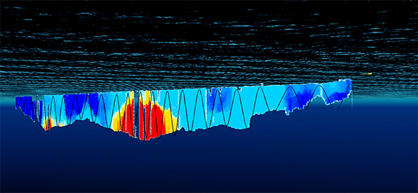
 Energy from the sun drives the Earth’s weather and climate. The ocean and atmosphere absorb energy and redistribute that heat through ocean currents and atmospheric winds. The amount of heat stored and redistributed in the ocean is immense, with the upper two meters of the ocean containing as much heat as the Earth’s atmosphere. Scientists are relatively good at forecasting the atmosphere’s weather. But how well can we forecast the ocean’s weather?
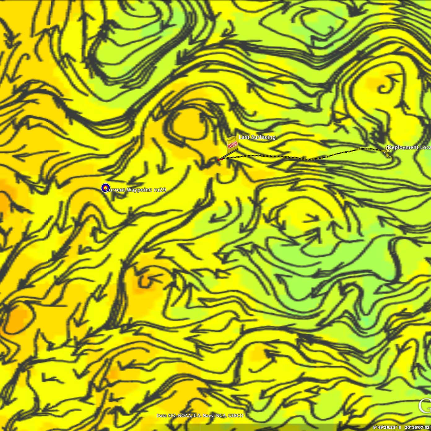
A number of existing technologies provide pieces of the overall picture. Satellites give us global maps of the surface temperatures. Argo, the global array of over 3,000 free-drifting profiling floats, measures the temperature and salinity of the upper 2,000m of the ocean, but does not resolve the boundary currents and eddy fields. Altimeters provide surface currents, but heat transport depends on a combination of the temperature structure and the current profile.
THE LACK Of CONFIDENCE ON HOW THE SURFACE REFLECTS THE DEEP SEA RAISES A SUITE OF CRITICAL QUESTIONS:
- How well do our global forecast models predict the variability around the fast moving edges of the major ocean gyres where the heat transport is greatest?
- Can we observe and quantify the subsurface heat transport in critical regions?
- Does the assimilation of deep glider data profiles improve the forecasts?
- What are the optimal paths for gliders to maximize their forecasting impact?
- When are embedded high-resolution regional models required to properly model the intraction of the deep water gyre circulation with the coastal waters?
- How well do the available regional models do with and without assimilation of the deep glider data?
Researchers around the globe hope to address these and other questions with the Challenger Glider Mission.
The mission will create a new culture of collaboration among an internationally distributed team of scientists and students who have a shared goal of better understanding the oceans critical role in climate and weather.